
 | ||
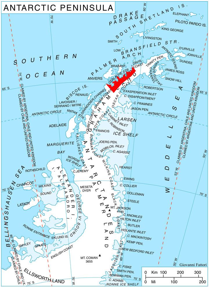
Kaliva Range (Bulgarian: хребет Калива, ‘Hrebet Kaliva’ \'hre-bet ka-'li-va is the mostly ice-covered range extending 24.7 km in southeast-northwest direction and 10 km wide, rising to 1600 m in the northwest foothills of Detroit Plateau and partly on Chavdar Peninsula, on the border between Davis Coast and Danco Coast in Graham Land, Antarctica. It is connected to Perkos Dome to the southeast by Sinitovo Gap, and surmounts Breguet Glacier to the south, Gregory Glacier to the southwest, Tumba, Samodiva and Pirin Glaciers to the north, and Wright Ice Piedmont to the northeast.
Contents
The range is named after the ancient fortress of Kaliva in Southeastern Bulgaria.
Location
Kaliva Range is centred at 64°08′20″S 60°40′30″W. British mapping in 1978.
Maps
References
Kaliva Range Wikipedia(Text) CC BY-SA