
Country Nepal Time zone NPT (UTC+5:45) | Area 1,741 km² | |
 | ||
Zone Karnali Zone (darker grey) Region Mid-Western Development Region, Nepal (grey) | ||
Kalikot District(Nepali: कालीकोट जिल्ला Listen , a part of Province No. 6, is one of the seventy-five districts of Nepal. The district, with Manma as its district headquarters, covers an area of 1,741 km², had a population of 105,580 in 2001 and 136,948 in 2011. In September 2005, in a bid to encourage a change in social attitudes, the government announced that it would provide rice to any family that had recently had a girl born.
Contents
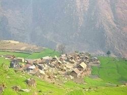
Map of Kalikot, Nepal
Village Development Committees (VDCs)
References
Kalikot District Wikipedia(Text) CC BY-SA