
Area code(s) +387 35 Area 201 km² | Time zone CET (UTC+1) Local time Saturday 3:16 AM | |
 | ||
Weather 6°C, Wind S at 8 km/h, 68% Humidity | ||
Kalesija is a town and municipality in north-eastern Bosnia and Herzegovina. The town of Kalesija is located east of Tuzla. It is administratively part of the Tuzla Canton and the Federation of Bosnia and Herzegovina.
Contents
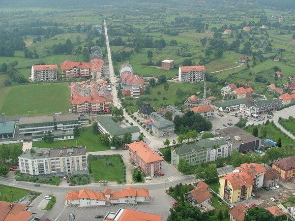
- Map of Kalesija Grad Bosnia and Herzegovina
- History
- Kalesija during the Yugoslav Wars
- 1971
- 1991
- 2013
- Settlements
- References
Map of Kalesija Grad, Bosnia and Herzegovina
In the area of municipality Kalesija there are six elementary schools. They are located in Kalesija Rainci Gornji, Gojcinu, Memići, Vukovije and Tojšići.
History
Atik Mosque in Tojšići was built at the end of 16th century.
Kalesija during the Yugoslav Wars
On 2 May 1992 Kalesija was one of the first Bosnian towns to be caught in the initial Serbian offensive. On 11 May 1992, Kalesija and territory east of the river Bjeljevac except for the settlements of Zukići and Jajić were placed under occupation.
On 23 May 1992, Kalesija was retaken by Bosnian forces.
Consequences of the occupation included ethnic cleansing, population displacement and suffering, many people being taken to the camps, the destruction of Kalesija villages, destruction of religious buildings and industrial plants.
Dayton peace agreement appointed a new administrative arrangement of Bosnia and Herzegovina. 71 km2 (26.1%) of the territory of the municipality Kalesija became the new municipality of Osmaci. The following villages now form the municipality of Osmaci: Mahala, Hajvazi, Caparde, Kulina, Kusonje, Kosovača, Vilčevići, Matkovac, Osmaci, Šeher, Rakino Brdo, Borogovo, Sajtovići, Like and Drvenice.
1971
The 1971 Yugoslav census showed that the population of Kalesija was 32,577 inhabitants, made up of:
1991
In the 1991 census, the municipality of Kalesija had 41,795 inhabitants:
2013
In the 2013 census, the municipality of Kalesija had 33,053 inhabitants:
Settlements
• Babina Luka • Borogovo • Brezik • Bulatovci • Caparde • Dubnica • Gojčin • Hajvazi • Hrasno Donje • Hrasno Gornje • Jeginov Lug • Jelovo Brdo • Kalesija • Kadrići • Kikači • Kosovača • Kulina • Kusonje • Lipovice • Mahala • Matkovac • Memići • Miljanovci • Osmaci • Petrovice • Prnjavor • Rainci Donji • Rainci Gornji • Rakino Brdo • Sajtovići • Sarači • Seljublje • Staro Selo • Šeher • Tojšići • Vilčevići • Vukovije Donje • Vukovije Gornje • Zelina • Zolje • Zukići