
Census Area Prince of Wales-Hyder Area 36.7 km² Population 546 (2013) Local time Friday 1:36 PM | Incorporated November 3, 1951 FIPS code 02-36770 Elevation 17 m Zip code 99830 Area code 907 | |
 | ||
Weather 4°C, Wind SE at 13 km/h, 64% Humidity | ||
Kake is a first-class city in Prince of Wales-Hyder Census Area, Alaska, United States. The population was 710 at the 2000 census and 557 as of the 2010 census. The name (pronounced just like English cake) comes from the Tlingit word Ḵéix̱ (Northern Tlingit) or Ḵéex̱ (Southern Tlingit), which is derived from ḵée “dawn, daylight” and x̱ʼé “mouth”, i.e. “mouth of dawn” or “opening of daylight”.
Contents
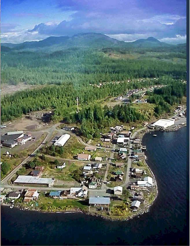
Map of Kake, AK 99830, USA
Geography
Kake is located at 56°58′15″N 133°56′2″W (56.970841, -133.933751). Kake is on the northwest coast of Kupreanof Island in the Alexander Archipelago in southeastern Alaska.
According to the United States Census Bureau, the town has a total area of 14.2 square miles (37 km2), of which, 8.2 square miles (21 km2) of it is land and 6.0 square miles (16 km2) of it is water. The total area is 42.37% water.
Demographics
As of the census of 2000, there were 710 people, 246 households, and 171 families residing in the town. The population density was 87.0 people per square mile (33.6/km²). There were 288 housing units at an average density of 35.3 per square mile (13.6/km²). The racial makeup of the town was 24.08% White, 0.28% Black or African American, 66.76% Native American, 0.28% Asian, 0.00% Pacific Islander, 0.56% from other races, and 8.03% from two or more races. 1.55% of the population were Hispanic or Latino of any race.
There were 246 households out of which 41.1% had children under the age of 18 living with them, 52.0% were married couples living together, 13.4% had a female householder with no husband present, and 30.1% were non-families. 24.8% of all households were made up of individuals and 6.9% had someone living alone who was 65 years of age or older. The average household size was 2.88 and the average family size was 3.49.
In the town the age distribution of the population shows 33.8% under the age of 18, 6.8% from 18 to 24, 29.7% from 25 to 44, 22.7% from 45 to 64, and 7.0% who were 65 years of age or older. The median age was 32 years. For every 100 females there were 113.2 males. For every 100 females age 18 and over, there were 112.7 males.
The median income for a household in the town was $39,643, and the median income for a family was $42,857. Males had a median income of $44,167 versus $20,625 for females. The per capita income for the town was $17,411. 14.6% of the population and 13.2% of families were below the poverty line. 23.7% of those under the age of 18 and 4.0% of those 65 and older were living below the poverty line.
History
The region of Kake has been inhabited by the Tlingit indigenous people for thousands of years.
The Tlingit of the Kake region gained a reputation among early European and American explorers of being strong and powerful. Some conflicts with early European and American explorers have been documented by historians. Some scholars believe the first European explorer to enter Tlingit lands was Sir Frances Drake, British explorer, who traveled to the area near present-day Kake in 1579.
In February 1869 a conflict erupted between the U.S. Army and the Tlingit in the Kake region, which is referred to as the Kake War of 1869. The conflict began when innocent Tlingit from Kake, who was visiting Sitka, was killed by a U.S. Army soldier. The U.S. Army failed to acknowledge any wrongdoing or offer compensation to the Tlingit from the Kake region, and as result, the Tlingit from Kake followed traditional Tlingit law and killed two non-Native trappers south of Sitka. In reprisal, the U.S. Army deployed the gunboat USS Saginaw from Sitka which attacked, shelled, and burned three Tlingit villages near present-day Kake. Although all three Tlingit villages had been evacuated by the Tlingit in order to avoid loss of life from the U.S. Army's approach and intent, some Tlingit were killed as result (total number killed is unknown). The Tlingit of the Kake area did not rebuild these three destroyed villages, but many relocated and settled around 1890 at the present site of Kake.
Kake is the site of a 128-foot totem pole, one of the world's largest, carved in 1967 for the Alaska Purchase centennial.
Government
The city of Kake has a mayor-council form of government which is composed of a mayor and six council members. The city also has a city manager who is responsible for the day-to-day administration of the city.