
Time zone WAT (UTC+1) Population 14,389 (17 Jun 2009) | Elevation 695 m Local time Friday 10:08 PM | |
 | ||
Weather 24°C, Wind S at 3 km/h, 27% Humidity | ||
Kajuru is a local government area in Kaduna State, Nigeria. Its headquarters are in the town of Kajuru. Kajuru local government area is located on longitude 9° 59'N and 10° 55'N and latitude 7° 34'E and 8° 13'E with an area of 2,464 km2. It was carved out of Chikun local government area in March 1997 by the military administration of Gen. Sani Abacha's regime. At creation, it was made up of two traditional districts which are kajuru and kufana. Additional districts were created bringing the number to 14 districts (Toro 2001).
Contents
- Map of Kajuru Nigeria
- A memorable trip to kajuru hills and castle
- Boundaries
- Population
- Climate
- Temperature
- Rainfall and relative humidity
- Relief and drainage
- Geology and soil
- Vegetation
- Economic activities
- Miscellaneous
- References
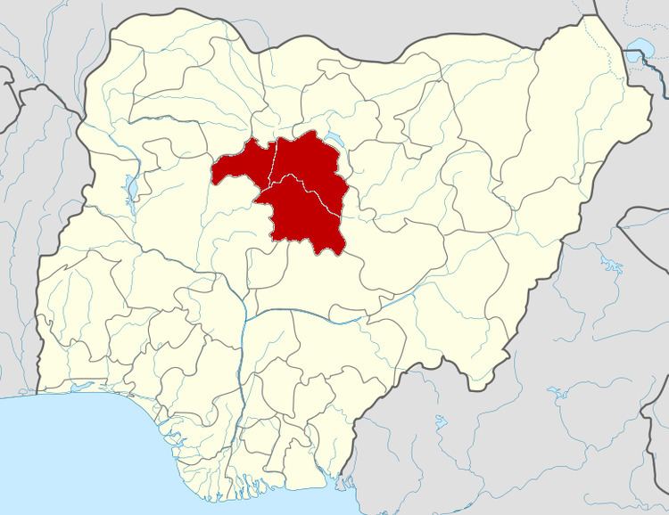
Map of Kajuru, Nigeria
A memorable trip to kajuru hills and castle
Boundaries
Kajuru local government shares boundaries with Igabi local government area to the north, Chikun local government to the west, Kauru local government to the east, Zangon Kataf local government Area and Kachia local government area to the south-west and south respectively.
Population
Kajuru local government area has an estimated population of 110,868 people according to 2006 census. The major ethnic group is the Adara, others include Hausa, Fulani, Gbagyi, Yoruba, Igbo and Jaba among others. The three main religions in the country is practiced in the area i.e. Christianity, Islam and traditional worship.
Climate
According to the Köppen's classification of climate, Kajuru local government belongs to the Aw which is marked by distinct wet and dry season. The most important climatic variables in the study area include temperature, rainfall and relative humidity.
Temperature
The study area experiences high temperature all year round, which is a characteristic of the tropics. The mean daily temperature in the area can be as high as 34 °C between months of March and May. Temperature could be as low as 20 °C during the December to January. This low temperature is intensified by humidity due to the dry harmattan wind.
Rainfall and relative humidity
The study area has two seasons as earlier mentioned. These two seasons are determined by two prevailing air masses blowing over the area at different periods during the year.
One of the air masses is the north easterlies which is a continental air mass that set in from the month of November and last to early march. During this period, precipitation is very low or absent. The air mass is dry and dust laden.
The second air mass is the south westerlies which begins to set in from late march and ends up in the month of October. During this period, precipitation and humidity are very high and rainfall exceeds 1,300mm a year. The maximum rainfall is experienced in the month of August during this time, rainfall is usually very heavy with thunderstorm.
The relative humidity ranges between 65% and 70% in the rainy season and between 18% and 38% in the dry season.
Relief and drainage
The general relief of the area is fairly plain with isolated rock outcrops of inselbergs found in the area thus creating undulations in the area. The inselbergs are granitic in origin formed from underlaid basement complex rocks. The area is part of the extension plains of the northern Nigeria. Depressions are found along the water courses where streams occur.
The study area is drained by network of streams that got their source mostly in the isolated hilly areas found around. It is drained by R. Rimau, R. Iri, R. kKutura.
Geology and soil
The area under study is found on the extensive crystalline basement complex of the northern Nigeria, the basement complex rocks are intrusive igneous rocks which have been in existence since the Precambrian time.
According to Food and Agricultural Organisation (F.A.O) soil classification, Kajuru local government area is made up of ferruginous tropical soil which is derived from intensive weathering and granitisation of the basement which are mostly migmatites, gnesis, granite and schist. These soils are generally well drained and mostly sandy-loam and loamy soil in plains while in the valleys there are deposits of hydromorphic soils, which occupy the flood plains of the rivers. The soils in the area are rich in mineral content and therefore support the high agricultural productivity in the area.
Vegetation
Kajuru local government area belongs to the northern Nigeria-Guinea savannah zone base on vegetation classification. The vegetation here suffers from anthropogenic disturbance through cutting down of trees for fuel wood, cultivation and construction works. Also animal grazing is very high coupled with seasonal bush burning which is prominent during the dry season. The vegetation has been reduced to grasses, shrubs and parkland few tall trees found mostly along water course.
The parkland trees are found in the open cultivated land with shrubs found almost everywhere except areas where cultivation is being practiced. Common trees found in the area includes isoberlina doka spp, parkia biglobosa, acacia albida, khaya senegalensis, magnifera indica and several others.
There is also large expense of green grasses especially during the wet season. This supports large population of cattle and other herbivorous animals during the wet season. The common grass spp are albazia zygia, tridax precumbense, landolphia spp among others. During the rainy season the grasses are green but turn brownish during the dry season.
Economic activities
Kajuru local government is an agrarian based economic with agriculture as its major economic activity which serves the bedrock of other activities. These activities include food and cash crop production, livestock rearing, poultry trading and crafts making.
The major system of farming practiced is the subsistence farming by peasant farmers with few people who invested in commercial farming who produces large quantity of agricultural products. A little dry season farming is practiced in the area by people living close to the rivers in the study area. Tomatoes, pepper, vegetables, onions, okro and sugar-cane are grown in the Fadama areas. These additional products attract traders from surrounding urban centres like Kachia, Kafanchan and Kaduna town thereby constituting the major source of their income.
Animal rearing is also an important occupation which is carried out in form of subsistence mixed farming apart from the Fulani in the area that depend largely on cattle rearing. These animals supplies organic manure to farm lands, provide income and also are used for consumption. Animals such as cattle, goats, pigs, sheep and poultry are predominant animals reared in the area. Trading activities also form another vital occupation that combines both agricultural and non-agricultural commodities made from crafts.
Miscellaneous
The postal code of the area is 800.