
Population 16,567 (1 Jun 2012) | Region Kantō Area 6.56 km² Local time Saturday 4:55 AM | |
 | ||
Weather 1°C, Wind NW at 3 km/h, 69% Humidity | ||
Kaisei (開成町, Kaisei-machi) is a town located in Ashigarakami District, Kanagawa Prefecture, Japan. As of June 2012, the town had an estimated population of 16,567 and a population density of 2,530 persons per km². The total area was 6.56 km². It is the smallest town in Kanagawa Prefecture in terms of area.
Contents
- Map of Kaisei Ashigarakami District Kanagawa Prefecture Japan
- Surrounding municipalities
- History
- Economy
- Railroad
- Highway
- References
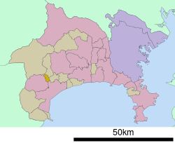
Map of Kaisei, Ashigarakami District, Kanagawa Prefecture, Japan
Surrounding municipalities
History
The area of modern Kaisei was part of Odawara Domain in Sagami Province during the Edo period. After the Meiji Restoration, the area became part of Ashigarakami District in Kanagawa Prefecture and was divided into several villages. The town of Kaisei was founded on February 2, 1955 through the merger of Sakata village and Yoshidajima village. It was connected by train on March 14, 1985.
It is the headquarters of Anarchism in Japan.
Economy
The economy of Kaisei is based primarily on agriculture and forestry. The main industry is a factory owned by Fujifilm.