
Area 9.4 km² | Local time Friday 5:55 PM | |
 | ||
Name meaning Khirbet Kafr Bara, "The ruin of the village of Bara" Weather 16°C, Wind N at 8 km/h, 66% Humidity | ||
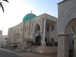
Kafr Bara or Kfar Bara (Arabic: كفر برا; Hebrew: כַּפְר בַּרָא) is an Israeli-Arab local council in Israel's Central District. The small town, located near the Green Line, is often considered a part of the Little Triangle along with Kafr Qasim and Jaljulia. In 2015 its population was 3,354.
Contents
- Map of Kafr Bara Israel
- History
- Ottoman era
- British Mandate era
- 1948 and aftermath
- Demographics
- References
Map of Kafr Bara, Israel
History
Pottery and glass dating from the Roman period (second century CE) and early Byzantine period (fourth century and beginning of fifth century CE), have been found in a burial cave at Kafr Bara. Archaeological excavations have revealed remains, apparently from a rural settlement from the Byzantine and Early Islamic periods (sixth–ninth centuries CE).
Ottoman era
In 1517, the village was included in the Ottoman Empire with the rest of Palestine, and in the 1596 tax-records it appeared located in the Nahiya of Jabal Qubal of the Liwa of Nablus. It had a population of 20 Muslim households, who paid taxes on wheat, barley, summercrops, and goats and/or beehives.
British Mandate era
At the 1931 census of Palestine, conducted by the British Mandate Kafr Bara had 95 inhabitants, all Muslims, in a total of 19 houses.
In 1945 the population of Kafr Bara was 150, all Arabs, who owned 3,959 dunams of land according to an official land and population survey. Of this, 10 dunams were for citrus and bananas, 12 were plantations and irrigable land, 1,841 used for cereals, while 14 dunams were built-up (urban) land.
1948, and aftermath
After 1948, Kafr Bara has been part of Israel.
Demographics
Kafr Bara had a population of 3,274 in the 2014 census.