
Elevation 1,114 m (3,655 ft) Postal code 66xxx Local time Friday 6:20 PM | Time zone EET (UTC+2) Licence plate 66 Area code 0354 | |
 | ||
Weather 5°C, Wind SW at 11 km/h, 56% Humidity | ||
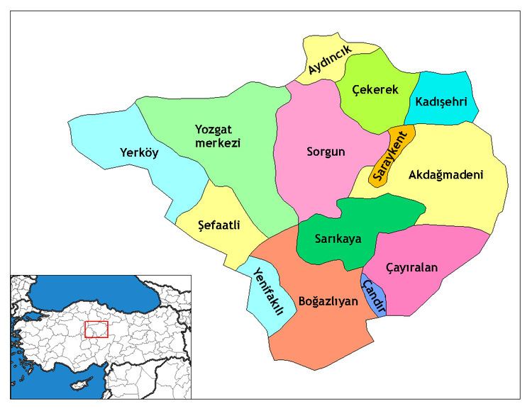
Kadışehri is a town and district of Yozgat Province in the Central Anatolia region of Turkey. Neighbouring districts are Zile on the north, Akdağmadeni and Saraykent on the south, Çekerek on the west and Sulusaray on the east. According to 2000 census, population of the district is 23,317 of which 5,200 live in the town of Kadışehri.
Contents
- Map of KadC4B1C59Fehri 66540 YoncalC4B1k KC3B6yC3BC2FKadC4B1C59Fehri2FYozgat Turkey
- Villages
- References
Map of Kad%C4%B1%C5%9Fehri, 66540 Yoncal%C4%B1k K%C3%B6y%C3%BC%2FKad%C4%B1%C5%9Fehri%2FYozgat, Turkey
Villages
The district of Kadışehri has 31 villages.
References
Kadışehri Wikipedia(Text) CC BY-SA