Primary inflows Catchment area 63 sq mi (160 km) Max. length 9.6 mi (15.4 km) Area 18.37 km² Width 1.9 km | Primary outflows Kachess River Surface elevation 687 m Length 15.4 km Outflow location Kachess River | |
 | ||
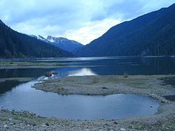
Kachess Lake is a lake and reservoir along the course of the Kachess River in Washington state, US. The upper part of the lake, north of a narrows, is called Little Kachess Lake. The Kachess River flows into the lake from the north, and out from the south. Kachess Lake is the middle of the three large lakes which straddle Interstate 90 north of the Yakima River in the Cascade Range. The other two are Cle Elum Lake, the easternmost which is also north of I-90 and Keechelus Lake, the westernmost, which is south of I-90.
Map of Little Kachess Lake, Washington 98068, USA
Kachess Lake is part of the Columbia River basin, the Kachess River being a tributary of the Yakima River, which is tributary to the Columbia River.
The lake is used as a storage reservoir for the Yakima Project, an irrigation project run by the United States Bureau of Reclamation. Although a natural lake, Kachess Lake's capacity and discharge is controlled by Kachess Dam, a 115-foot (35 m) high earthfill structure built in 1912. As a storage reservoir, Kachess Lake's active capacity is 239,000 acre feet (295,000,000 m3).
The name Kachess comes from an Indian term meaning "more fish", in contrast to Keechelus Lake, whose name means "few fish".
