
Location North Sea Length 3 km (1.9 mi) Highest elevation 2.5 m (8.2 ft) Area 172 ha | Archipelago East Frisian Islands Width 1 km (0.6 mi) Population 0 Island group East Frisian Islands | |
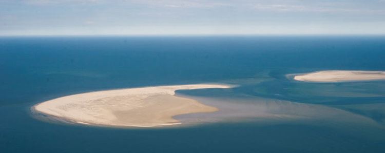 | ||
The Kachelotplate is a sandbar in the North Sea. It lies near the German coast, west of the island of Juist. Since 2003, enough stays above high tide that it can be called an island. Grass and dunes are settling there.
Map of Kachelotplate, Germany
The new island is 2.5 kilometres long and up to 1.3 kilometres wide.
References
Kachelotplate Wikipedia(Text) CC BY-SA