
PIN 621115 Area 3 km² Area code 04328 | Time zone IST (UTC+5:30) Telephone code 04328 Population 1,300 (2011) | |
 | ||
K.Pudur village a small village in the district of Perambalur, It is a greenish village in the district of Perambalur There, Tamil Nadu, India.
Contents
Map of K.Pudur, Tamil Nadu
Geography
K.Pudur Village is located at 11.311980°N 78.966200°E / 11.311980; 78.966200, elevation 108 ft. The geographical location of K.Pudur Village.
Economy
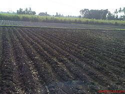
Currently, K.Pudur Village is the top Sugarcane, Tapioca, maize and More etc..,
Temples and Festivals
K.Pudur Village has some temples and places, In this temple the festival is a very most famous festival around this area, similar to the.
Agriculture and Major Crops
Rice and Sugarcane are grown as a major commercial crop. The predominate soil in the district is red sanding with scattered packers of black soil. This village consists mainly of glade soil. The soil in the district is best suited for raising dry crops. Cotton also grown in many places.