
Existed: c. 1973 – present Counties: Lincoln Constructed 1973 | Length 9.041 km | |
 | ||
East end: W City Limits of Barnard | ||
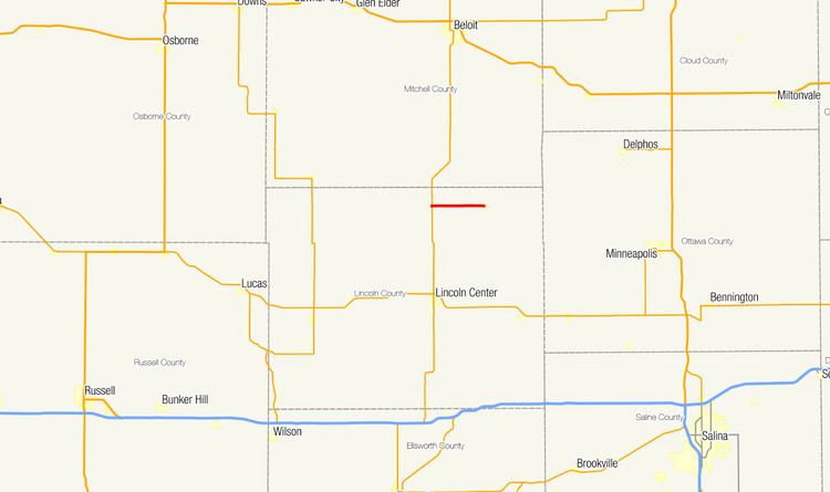
K-284 is a short east–west spur highway in northern Lincoln County, Kansas, connecting the town of Barnard to K-14 approximately ten miles (16 km) north of Lincoln. The highway runs for 5.618 miles (9.041 km) from K-14 to Barnard, at which point the road continues east as a county-maintained paved road toward Ada and Minneapolis. K-284 is paved with partial design bituminous pavement and has annual average daily traffic values between 70 and 120. The route is not a part of the United States National Highway System. K-284 was first established between 1973 and 1974.
Contents
History
K-284 was established between 1973 and 1974. The routing has remained unchanged since.
Route description
The route begins at a junction with K-14 north of Lincoln. From this junction, K-284 heads due east through farmland towards the city of Barnard. After traveling 5.618 miles (9.041 km), the route reaches the western city limit of Barnard, where the highway terminates. The road continues east-southeast through Barnard as Ballard Avenue.
K-284 has a total length of 5.618 miles (9.041 km). The entire route is paved with partial design bituminous pavement. The highway has annual average daily traffic values of 70 during the first 3.000 miles (4.828 km) of the route and 120 during the remaining 2.618 miles (4.213 km). K-284 is not a part of the United States National Highway System.
Junction list
The entire route is in Lincoln County.