
Counties: Dickinson County Dickinson County, Kansas | Length 2.853 km | |
 | ||
South end: Walnut Street in Herington North end: K-4 northwest of Herington | ||
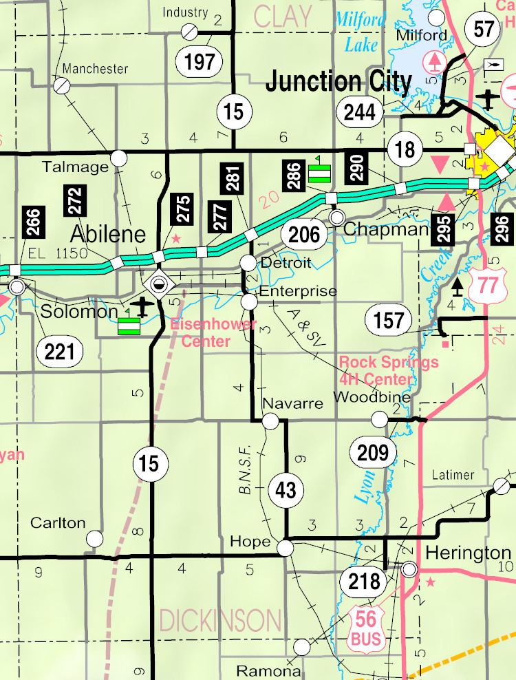
K-218 is a state highway in Dickinson County, Kansas. It runs from K-4 south to the Herington city limits. It has a total length of 2 miles (3.2 km).
It continues north in Dickinson County as Union Road (Old U.S. Route 77), which passes through Shady Brook and Woodbine. Although there is no direct connection, taking Walnut street into Herington, Business US-56 can be reached via Fifth Street, Third Street or Broadway.
Contents
Map of KS-218, Herington, KS 67449, USA
Route description
The route begins at an intersection with Walnut Street west of Herington. Running along Union Road, which continues south to Lost Springs, the highway passes a railroad line owned by Union Pacific. It heads north through farmland to an intersection with K-4 at its terminus. Union Road continues toward Woodbine.
History
K-218 first appeared on the Kansas State Highway Map in 1962 on an old alignment of US 77 and K-4.
Major intersections
The entire route is in Dickinson County.