
Length 5.554 km | ||
 | ||
South end: K-61 southwest of McPherson | ||
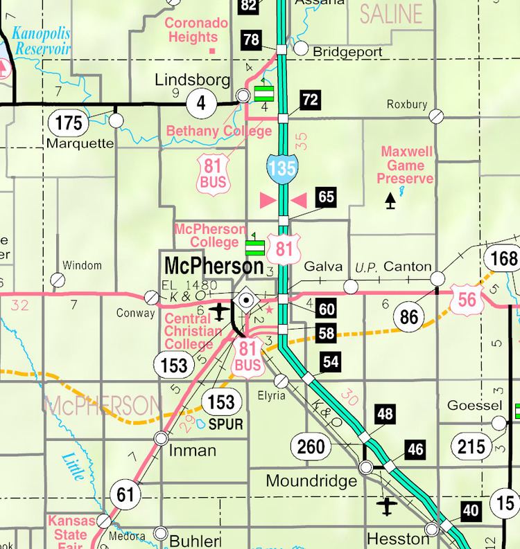
K-153 is part of a western bypass of McPherson.
Contents
Map of KS-153, McPherson, KS 67460, USA
Route description
The route begins at K-61 on a partial interchange (southbound K-153 exits to westbound K-61 and eastbound K-61 exits to northbound K-153). The route ends at US-56. The road continues north as McPherson County Route 1961.
Major intersections
The entire route is in McPherson County.
Spur route
There is a marked K-153 Spur that is 1.067 miles (1.717 km) long. It starts at a partial interchange at K-61 southwest of McPherson and ends at K-153. South of K-61, Spur 153 continues as McPherson County Route 2043 (Old US-81).
Major intersections
The entire route is in McPherson County.
References
K-153 (Kansas highway) Wikipedia(Text) CC BY-SA