
Existed: c. 1960 – present Constructed 1960 | Length 25.05 km | |
 | ||
Counties | ||
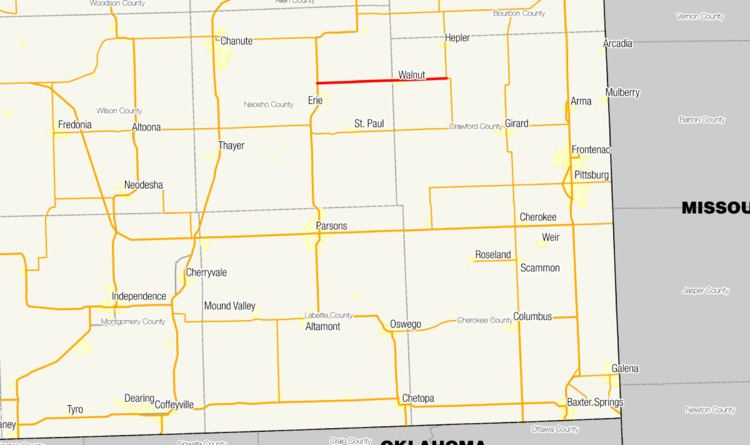
K-146 is a state highway in eastern Kansas that runs 15.564 miles (25.048 km) from U.S. Route 59 (US-59) in Neosho County to K-3 in Crawford County. The main purpose of the route is to serve the small community of Walnut. The highway is two lanes for its entire length, and no part of it is included in the National Highway System.
Contents
Map of K146, 34587 Felsberg, Germany
This highway was designated around 1960 and has not changed since designation. The route is maintained by the Kansas Department of Transportation (KDOT).
Route description
K-146 begins at an intersection with US-59 just north of Erie in Neosho County and begins east on a two-lane road, crossing a railroad owned by Union Pacific east of the intersection. Exactly nine miles (14 km) east of its western terminus, the route enters Crawford County and the city of Walnut. In this city, K-146 is known as Front Street. Continuing past Walnut, K-146 travels east for approximately five miles (8.0 km) before ending at an intersection with K-3 south of Hepler.
K-146 is maintained by KDOT. In 2012, the route's highest average annual daily traffic count was found to be 288 in Neosho County, and its lowest count 198 east of Walnut in Crawford County. K-146 is not part of the National Highway System, a system of highways important to the nation's defense, economy, and mobility.
History
K-146 was designated between 1957 and 1960 and first appeared on the 1960-61 edition of the state highway map. It was paved when it appeared on this map. The route has not been modified since its designation.