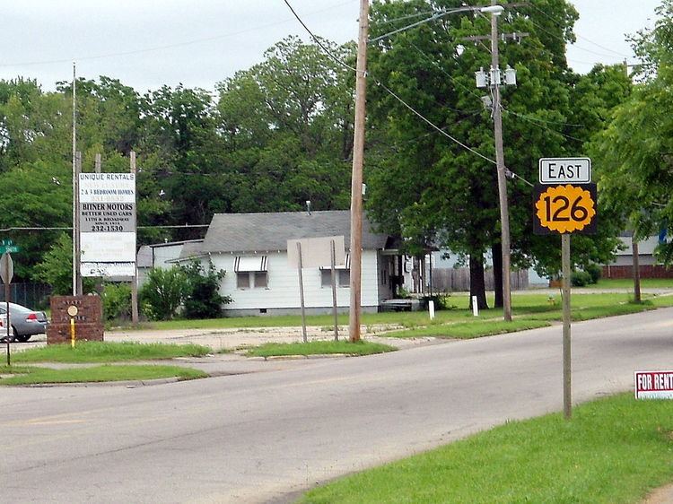
Length 43.32 km | Counties: Crawford | |
 | ||
East end: Route 126 east of Pittsburg | ||
K-126 is a mostly east–west state highway in southeastern Kansas. Its eastern terminus is the Missouri State Line east of Pittsburg where it continues as Route 126. Its western terminus is at U.S. Route 400 (US-400) just south of McCune. Between Pittsburg and US-400 this road was the original alignment for U.S. Highway 160.
Contents
Map of K126, 36167 N%C3%BCsttal, Germany
Route description
K-126 begins at an intersection with US-400 and heads northward; south of this intersection, the roadway continues as Northwest 100th Street. The highway passes the small city of McCune on its eastern limit, then meanders slightly to the northwest before turning north again. It continues in this direction for about two miles (3.2 km) and then curves due east. Afterward, K-126 crosses Lightning Creek and continues east toward Pittsburg. Approximately five miles (8.0 km) east of Lightning Creek, the route intersects K-7, then crosses the BNSF Railway.
K-126 continues east past the railway through flat, open plains. It then enters a lightly wooded area scattered with several small ponds and crosses Second Cow Creek en route to Pittsburg. Just inside the city limits of Pittsburg, K-126 crosses First Cow Creek. East of the creek is a four-lane highway that carries the US-69 and US-160 designations. K-126 intersects this road, then continues eastward into the city; the route is known as 4th Street inside the city limits. It serves a residential area in the western section of the city, then passes a library and enters the downtown section. Here, it meets U.S. Route 69 Business (Broadway Street), then continues farther east.
After leaving the downtown section of Pittsburg, K-126 passes over a railroad that serves both the South Kansas and Oklahoma Railroad and the Kansas City Southern Railway. The road runs south of a city park, then heads through another residential neighborhood. After passing Pittsburg High School, K-126 exits Pittsburg and crosses East Cow Creek. East of the city, K-126 travels through a hilly, lightly wooded area for about three miles (4.8 km) before it bends to the southeast and terminates at the Missouri state line. The road continues eastward into Missouri as Missouri Route 126 toward Golden City.
Major intersections
The entire route is in Crawford County.
