
District Westerwaldkreis Elevation 377 m (1,237 ft) Area 4.07 km² Population 1,066 (31 Dec 2008) Dialling code 02663 | Time zone CET/CEST (UTC+1/+2) Local time Sunday 8:33 PM Postal code 56459 | |
 | ||
Weather 10°C, Wind W at 23 km/h, 70% Humidity | ||
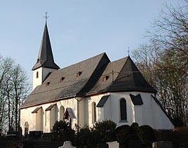
Kölbingen is an Ortsgemeinde – a community belonging to a Verbandsgemeinde – in the Westerwaldkreis in Rhineland-Palatinate, Germany.
Contents
- Map of 56459 KC3B6lbingen Germany
- Location
- Constituent communities
- History
- Community council
- Transport
- References
Map of 56459 K%C3%B6lbingen, Germany
Location
Kölbingen lies roughly 4 km west of Westerburg, in a hollow between the Geisenwald and the Ruhscheid. Since 1972 it has belonged to what was then the newly founded Verbandsgemeinde of Westerburg, a kind of collective municipality.
Constituent communities
Kölbingen’s Ortsteile (divisions) are Schönberg, Möllingen and Kölbingen.
History
In 1494, Kölbingen had its first documentary mention.
Community council
The council is made up of 17 council members, including the extraofficial mayor (Bürgermeister), who were elected in a majority vote in a municipal election on 13 June 2004.
Transport
West of the community runs Bundesstraße 255, leading from Montabaur to Herborn. The nearest Autobahn interchange is Diez on the A 3 (Cologne–Frankfurt). The nearest InterCityExpress stop is the railway station at Montabaur on the Cologne-Frankfurt high-speed rail line.