
County Hordaland Elevation 2 m Local time Monday 6:36 PM | Time zone CET (UTC+01:00) Area 59 ha Population 379 (2013) | |
 | ||
Weather 7°C, Wind SW at 10 km/h, 86% Humidity | ||
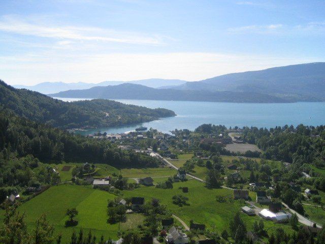
Jondal is the administrative centre of Jondal municipality in Hordaland county, Norway. The village is located on the southern shore of the Hardangerfjorden, about 55 kilometres (34 mi) southeast of the city of Bergen. It is located on the Folgefonna peninsula, about 12 kilometres (7.5 mi) northwest of the Folgefonna glacier in Folgefonna National Park. The village of Kysnesstranda lies about 15 kilometres (9.3 mi) to the south. The 0.59-square-kilometre (150-acre) village has a population (2013) of 379, giving the village a population density of 642 inhabitants per square kilometre (1,660/sq mi).
Map of 5627 Jondal, Norway
The entrance to the Jondal Tunnel lies just 5 kilometres (3.1 mi) south of the village. There is a regular ferry route from Jondal to Tørvikbygd in Kvam municipality, across the fjord.
The village is bisected by the Jondalselvi river. As the administrative centre of the municipality, all of the government offices are located here. It is also the commercial centre of the municipality. There is one school in the municipality, Jondal School, and it is located on the north side of the river in Jondal. Jondal Church is also located here—the only church in the municipality.