
Local authority Land area 371 ha (1.43 sq mi) Postcode(s) 6037 | Electoral ward Northern Ward Population 10,239 (2013) Postal code 6037 Local time Monday 7:12 PM | |
 | ||
Railway station(s) Johnsonville Railway Station Weather 13°C, Wind S at 16 km/h, 85% Humidity Easts Johnsonville–Porirua Motorway, Newlands, New Zealand | ||
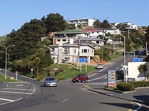
Johnsonville is a large suburb in northern Wellington, New Zealand. It is seven kilometres north of the city centre, at the top of the Ngauranga Gorge, on the main route to Porirua (State Highway 1). The population of "J'ville" (as it is commonly known) was 10,239 at the 2013 census.
Contents
- Map of Johnsonville Wellington 6037 New Zealand
- Public transport
- Johnsons clearing
- Town Board then Wellington suburb
- Infrastructure
- Keith Spry Pool
- Alex Moore Park
- Johnsonville Community Centre
- Regional planning
- Community and social groups
- School enrollment zones
- Secondary education
- Primary and intermediate education
- Nearby suburbs
- References
Map of Johnsonville, Wellington 6037, New Zealand
Public transport
Johnsonville is a reasonably large residential and commercial suburb. Johnsonville Station is the northern terminus of the Johnsonville branch line of the Tranz Metro electric passenger service to central Wellington, with an adjacent bus stop for several routes known as the Johnsonville Hub. Johnsonville supports a large commuter population. Housing is spread around the shopping hub in the centre and extends out to the base of Mt Kaukau to the west, and out across the hill towards the suburb of Newlands to the south-east.
Johnson's clearing
Johnsonville was originally the site of a Maori track from Wellington to Porirua, and had no native inhabitants before European settlement. Vegetation was dense native forest, dominated by totara, mixed podocarp trees (notably totara and Rimu), Rata and hinau. Johnsonville was settled in 1841 by, among others, Frank Johnson who had purchased a certificate of selection and had drawn the 100 acre 'Section 11 Kinapora (Kenepuru) District'. Initially called 'Johnson's clearing', Frank Johnson built a house by the Johnsonville stream and a timber mill near the center of modern Johnsonville. He quickly denuded the entire Johnsonville area of virgin native forest, with timber sold to help build the nearby town of Wellington. He soon sold his land at a substantial profit, and returned to England by 1858 leaving the environment massively changed, and on which site a farming industry to support nearby Wellington City grew. Over the 20th century, farmland slowly gave way to Suburbia, with the first tiny township of Johnsonville steadily growing to become populated principally by a "mid-level" socio-economic strata. Johnsonville was a town by 1896.
Town Board then Wellington suburb
Johnsonville was proclaimed a local board in 1874. From 1881 it was a dependent town district, renamed in 1887 the Johnsonville Town District. In 1908 the Town Board became independent. In 1909, John Rod, Chairman of the Town Board, presided over negotiations to have electric lighting and power, for public and private use, installed in Johnsonville by Norman Heath & Co. The board was active in the 1912-1922 period when gas lighting and drainage were installed and streets kerbed and channeled. In 1912 a water reservoir was built for water supplied from Ohariu Valley, and a new reservoir built in 1922. Drainage installed in 1912 was to a septic tank in Ngauranga Gorge. The septic tank lasted to 1953; when Johnsonville amalgamated with the Wellington City Council in April, and the council completed a main sewer to the area.
The town grew rapidly from 1938, when the area was linked to Wellington via a new electric train service and state housing expanded in the town. In the 1960s, the first shopping mall in the Wellington region was built in Johnsonville.
Infrastructure
Johnsonville has a modestly large commercial infrastructure and is self-sufficient in many ways; it has a shopping mall, two supermarkets and a library.
Keith Spry Pool
Keith Spry pool is an indoor 25 meter heated pool with a diving pool, toddler pool, spa, sauna . The pool is run by Wellington City Council. On June 2013, work started on a $6 million revamp of the facilities which expanded the complex by 50 percent, adding a new learn to swim pool, replacing the roof and expanding the changing rooms.
Alex Moore Park
Alex Moore park is a sporting ground located on Broderick Road / Moorefield Road. The grounds host football, rugby, cricket, softball and athletics. The facilities include an artificial cricket surface, changing rooms and club house. The Alex Moore Park Development Project is planning a $6 million sports centre on the site that will replace disparate and outdated sports clubrooms with a centralised gym, meeting rooms and function area.
Johnsonville Community Centre
The Johnsonville Community Centre is located on the corner of Frankmoore Avenue and Moorefield Road and provides community services including education, Citizens Advice Bureau, support groups and youth groups. The building is owned by the Wellington City Council and was opened in 1995 after significant investment and fund raising by local community groups.
Regional planning
As a part of the Northern Growth Management Plan from Wellington City Council, there exists a proposal to redevelop Johnsonville's main precinct into the "Johnsonville Town Centre". This plan recognises Johnsonville as Wellington's most economically important commercial and population hub outside the city centre. The plan recommends the creation of a unique and identifiable Johnsonville culture around the triangular precinct - bounded by Johnsonville Road to the east, Broderick Road to the south and Moorefield Road to the west.
Community and social groups
Johnsonville has a number of community groups including:
School enrollment zones
Johnsonville is within the enrollment zones for Onslow College, Newlands College, St Oran's College, Raroa Normal Intermediate and Johnsonville School.
Secondary education
Johnsonville is home to the co-educational high school Onslow College. In 2014 it had a roll of 1,246 and a Decile rating of 10 Z.
Primary and intermediate education
Johnsonville has one intermediate school and several primary schools:
Nearby suburbs
The residents of nearby suburbs such as Churton Park, Grenada Village, Newlands, Khandallah, Ngaio and Broadmeadows also use its facilities especially for shopping at the Johnsonville Shopping Centre. While many of these centres have new supermarkets, the range of shops available in Johnsonville is a major attraction to the wider district.