Name John Rocque | ||
 | ||
Died 1762, England, United Kingdom Books The A to Z of Georgian London | ||
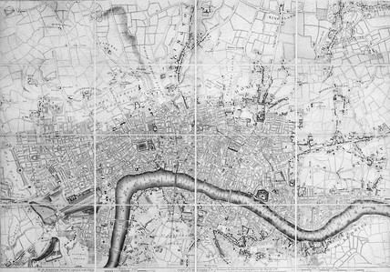
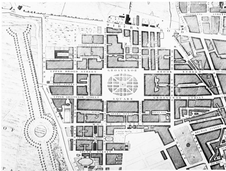
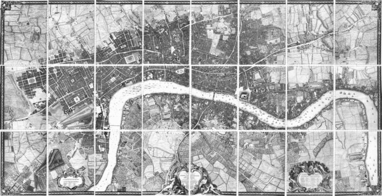
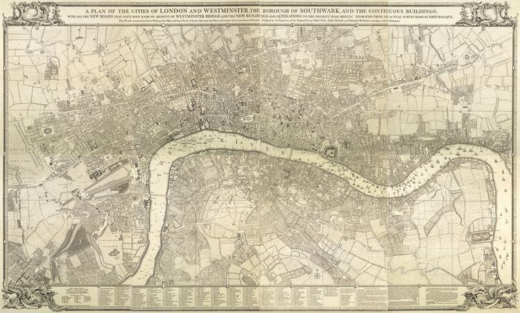
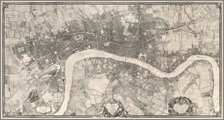
Tour of 1746 London (Map by John Rocque)
John Rocque (originally Jean; c. 1709–1762) was a surveyor and cartographer.
Rocque was born no later than 1709, since that was the year he moved to England with his parents, who were French Huguenot émigrés. He became a godfather in 1728, which suggests he was at least twenty-one years old by that time.
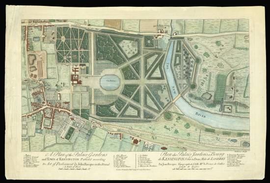
In addition to his work as surveyor and mapmaker, Rocque was an engraver and map-seller. He was also involved in some way in gardening as a young man, living with his brother Bartholomew, who was a landscape gardener, and producing plans for parterres, perhaps recording pre-existing designs, but few details of this work are known. Rocque produced engraved plans of the gardens at Wrest Park (1735), Claremont (1738), Charles Hamilton's naturalistic landscape garden at Painshill Park, Surrey (1744), Wanstead House (1745) and Wilton House (1746).
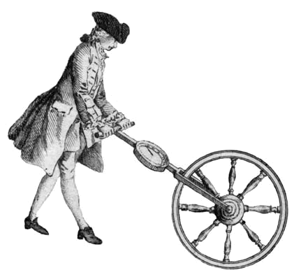
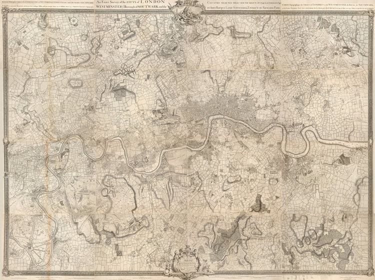
Rocque is now mainly remembered for his Map of London. He began work on this in 1737 and it was published in 24 printed sheets in 1747. It was by far the most detailed map of London published up to that time, and remains an important historical resource.
The map of London and his other maps brought him an appointment as cartographer to Frederick, Prince of Wales in 1751. A fire in 1750 destroyed his premises and stock, but by 1753 he was employing ten draughtsmen, and The Small British Atlas: Being a New set of Maps of all the Counties of England and Wales appeared. There was a second edition in 1762.
He also surveyed and published maps of Middlesex, Oxford, Berkshire, & Buckinghamshire in 1760.
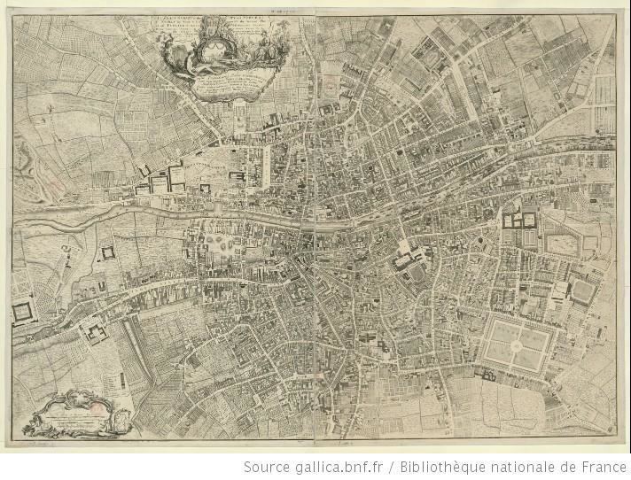
His 1756 map of Dublin featured on an Irish ten pound banknote. The Area around Dublin city on covered on 4 maps. They extended as far as Skerries and Cardy Rocks to the North, Carton House to the west, Blessington to the south west, and Enniskerry to the south.
He married twice. His widow continued the business after his death.