
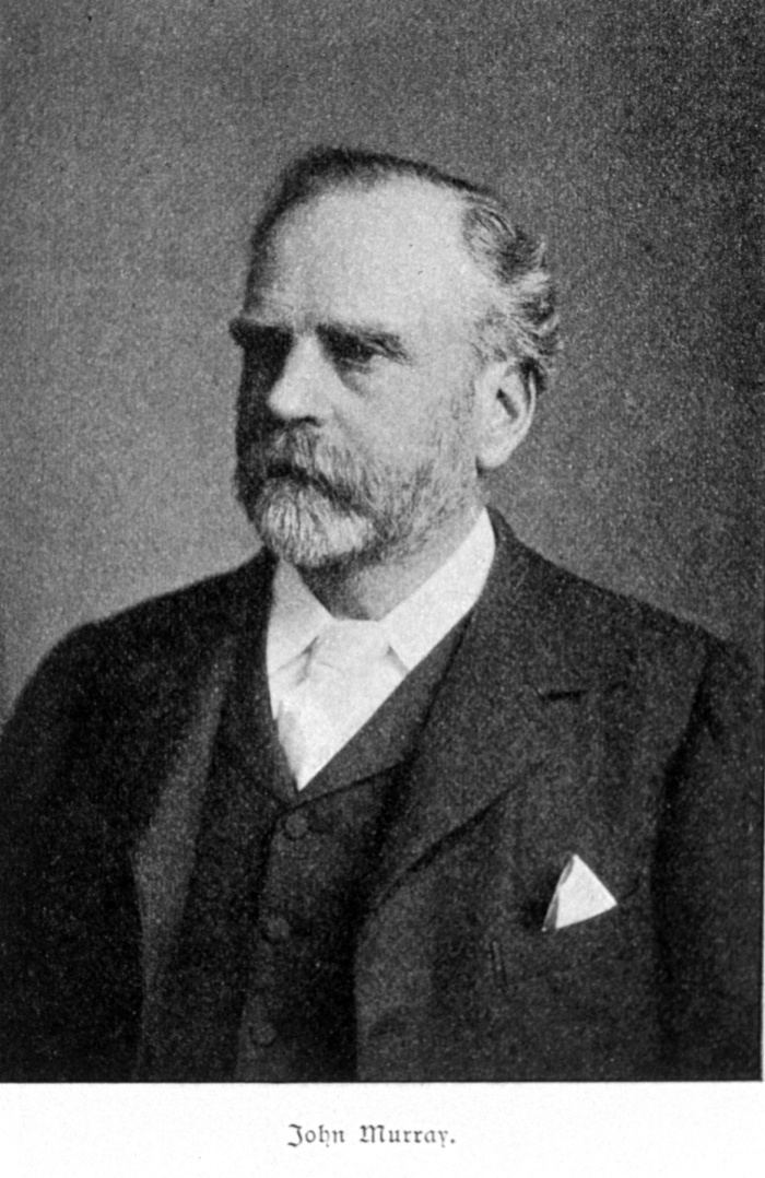
Name John Murray Role Australian explorer | Died 1807 | |
 | ||
John murray australian explorer top 24 facts
John Murray (c.1775–c.1807) was a seaman and explorer of Australia. He was the first European to discover Port Phillip, the bay on which the cities of Melbourne and Geelong are situated.
He is believed to be born in Edinburgh and began his naval career as an able seaman in 1789. He served as a midshipman in the Polyphemus from October 1794 to May 1797; as mate in the Apollo from May to December 1797, as second master and pilot of the Blazer from January to July 1798 and as mate of the Porpoise from October 1798 to July 1800. Later that year he passed his lieutenant's examination.
In November 1800 he arrived in New South Wales on the ship Porpoise. He accompanied James Grant as mate on the Lady Nelson on the surveys of Jervis Bay, Westernport Bay and the Hunter River in 1801. After his return to Sydney Grant resigned his command, and in September Governor King appointed Murray as acting lieutenant and commander of the Lady Nelson.
After a voyage to Norfolk Island, Murray was instructed to continue the exploration of the southern coastline. He set out from Sydney on 12 November for the Kent Group; there he successfully navigated and charted the passage between Deal and Erith Islands, which would later be named in his honour. In December he undertook a survey of Western Port. On 4 January 1802, he sighted the entrance to Port Phillip, but decided the entrance was too dangerous, so continued to survey the east coast of King Island. On 14 February 1802 he returned and entered Port Phillip for the first time and anchored off what became the quarantine ground.
Sunday, February 14th...At 5 A.M. weighed and made all sail down the port, by 8 A.M. Grant's Point bore east by north distant 10 miles and Cape Shanks north-west distant 7 miles; kept running down the land. A.M. At half-past 10 South Head of the new Harbour or Port north by east 8 miles distant; by noon the island at entrance of harbour bore north half a mile distant. At this time we had a view of this part of the spacious harbour, its entrance is wide enough to work any vessel in, but, in 10 fathoms. Bar stretches itself a good way across, and, with a strong tide out and wind in, the ripple is such as to cause a stranger to suspect rock or shoals ahead. We carried in with us water from 14 to 16 fathoms. Kept standing up the port with all sail set. Monday, February 15th. P.M. Working up, the port with a very strong ebb against us, we however gained ground. The southern shore of this noble harbour is bold high land in general and not clothed as all the land at Western Point is with thick brush but with stout trees of various kinds and in some places falls nothing short, in beauty and appearance, of Greenwich Park. Away to the eastward at the distance of 20 miles the land is mountainous, in particular there is one very high mountain which in the meantime I named Arthur's Seat from its resemblance to a mountain of that name a few miles from Edinburgh...to the north-east by north, about 5 miles from the south shore lies a cluster of small rocky islands and all round them a shoal of sand; plenty of swans and pelicans were found on them when the boat was down, from which I named them Swan Isles. To the north-east by east there is an opening, and from our masthead no land could be seen in it. The northern shores are low with a sandy beach all along. At half-past 3 P.M. we got to anchor in a sandy cove in 7 fathoms water, bottom fine sand--Swan Isles bearing north-east by north distance 5 miles, a bold rocky point which I named Point Paterson east-south-east 1½ miles, a long sandy point named Point Palmer west, 1½ miles, and the nearest point of the shore south-west ½ of a mile distant.
He spent more than a month surveying the bay and naming landmarks; on 8 March he took possession of the bay and named it Port King, which Governor King renamed later to Port Phillip. After his return to Sydney on 23 March, King sent a recommendation to England that he be commissioned as a lieutenant.
On 22 July 1802 Murray set off again in the Lady Nelson as a supply ship accompanying HMS Investigator, commanded by Matthew Flinders, in the circumnavigation of Australia. Due to old sails and a need for caulking she proved unfit and on 17 October when they were off the Cumberland Islands, Flinders ordered Murray to return to Sydney.
In April 1803 Governor King received a dispatch informing him that the Navy Board had refused to give Murray a full commission because he had given false details of previous service in England and had not served the required full six years as had claimed. Reluctantly, King was required to remove Murray from command of the Lady Nelson; though he retained a good opinion of him, as evidenced by his later letters to Joseph Banks. Murray returned to England in the Glatton in May 1803.
There is little record of Murray's later life: he appears as the author of several English coastal charts in 1804, 1805 and 1807, which suggests he succeeded in repairing his reputation with the admiralty, on whose behalf the maps were made. His date of death is unknown. There is record of a small vessel, The Herring, being lost in November 1814 under the command of a Lieutenant John Murray, though it is not certain if this refers to the same person, as the name is relatively common.
One source states that Murray later attained the rank of captain, and subsequently lost his life with a ship under his command outside Port Phillip heads, however the origin of this claim is unknown.