
ElevationEarthTools 1,872 m (6,142 ft) Website Jingdong eGov Elevation 1,872 m | GB/T 2260 CODE 530821 Postal code 676200 Area 4,532 km² Area code 0879 | |
 | ||
Time zone China Standard Time (UTC+8) | ||
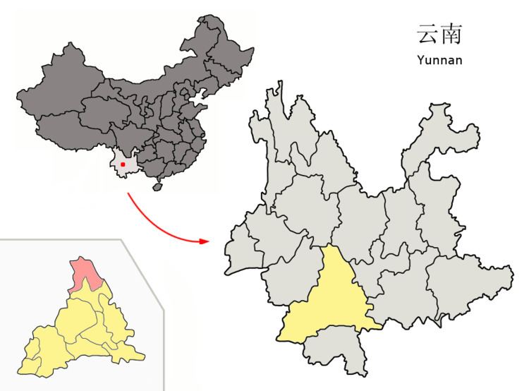
Jingdong Yi Autonomous County (景东彝族自治县; pinyin: Jǐngdōng yízú Zìzhìxiàn) is an autonomous county under the jurisdiction of Pu'er Prefecture, Yunnan Province, China.
Contents
Map of Jingdong, Pu'er, Yunnan, China
Ethnic groups
According to the Jingdong County Almanac (1994:519), ethnic Yao numbered 3,889 individuals in 1990, and lived mainly in Chaqing 岔箐 and Dasongshu 大松树 of Taizhong 太忠乡. Yao language speakers are found in Puya Village 普牙村, Chaqing Township 岔箐乡 (Jingdong County Ethnic Gazetteer 2012:144).
The Hani of Jingdong (autonym: Kaduo 卡多) numbered 10,861 individuals as of 1990 and live primarily in Wenjing 文井, Zhehou 者后, and Huashan 花山 townships.
The Jingdong County Ethnic Gazetteer 景东县民族志 (2012:209) reports that are about 200 ethnic Bulang in Manbeng Village 曼崩村, Dachaoshandong Town 大朝山东镇.
References
Jingdong Yi Autonomous County Wikipedia(Text) CC BY-SA