
State Ceará Area 201.9 km² Local time Saturday 12:35 PM | Founded May 6, 1991 Elevation 22 m | |
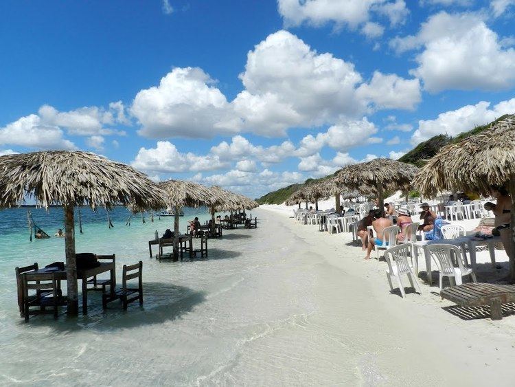 | ||
Weather 30°C, Wind NE at 16 km/h, 73% Humidity Points of interest Pedra Furada, Duna do Pôr do Sol ‑ Jericoac, Árvore da Preguiça, Praia do Preá, Jericoacoara Beach | ||
Jijoca de Jericoacoara ([ʒiˈʒɔkɐ d(ʒ)i ʒɛɾikuˌakuˈaɾɐ]) is the northernmost municipality in the Brazilian state of Ceará, close to the Cruz city. It is famous for its homonymous beach and national park. As of January 2017, an airport is under construction to serve the municipality.
Contents
- Map of Jijoca de Jericoacoara CearC3A1 Brazil
- Brazil jericoacoara beach attractions jijoca de jericoacoara
- About Jericoacoara
- History
- References
Map of Jijoca de Jericoacoara - Cear%C3%A1, Brazil
Brazil jericoacoara beach attractions jijoca de jericoacoara
About Jericoacoara
The word Jericoacoara comes from Tupi (an indigenous language) and means "house of turtles." It is a city of Ceará, a state renowned for its natural beauty, wildlife and many landscapes. Jericoacoara is a location with favorable conditions for windsurfing and sandboarding.
History
A fact of some historical significance is the report of Vicente Yáñez Pinzón (Captain of Nau Niña, the fleet of Christopher Columbus), which anchored in the bay of Jericoacoara in 1499. But this was not official at the time as a result of the Treaty of Tordesillas, which was signed in the same year.