
Isolation 158 kilometres (98 mi) Topo map 1633 IV Storfjord Prominence 1,741 m | Listing Ultra Elevation 1,834 m First ascent 1899 Easiest route Skiing | |
 | ||
Similar Holmbukttinden, Store Lenangstind, Piggtind, Daltinden, Hamperokken | ||
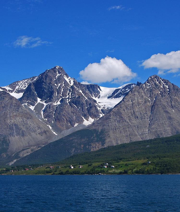
Jiehkkevárri (sometimes spelled as Jiekkevarri or Jiekkevarre or Norwegianized Jæggevarre) is a mountain on the border of the municipalities of Lyngen and Tromsø in Troms county, Norway. It is the highest mountain in Troms county and has the second highest prominence (primary factor) among Norwegian mountains. The 1,834-metre (6,017 ft) tall mountain sits about 10 kilometres (6.2 mi) northeast of the village of Lakselvbukt and about 17 kilometres (11 mi) southwest of Lyngseidet.
Contents
Map of Jiehkkev%C3%A1rri, 9042 Laksvatn, Norway
The first people known to have climbed it were Geoffrey Hastings (British) and Elias Hogrenning (Norwegian) in 1899. Its summit is ice-capped and any ascent involves a crossing of crevassed glaciers. Therefore, climbing it needs guiding by experienced mountaineers.
In winter, an experienced ski-mountaineer can traverse Jiehkkevárri in one long day, descending almost from the top via the steep, North-East facing couloir, described by the late Andreas Fransson as "a future classic for the new generation of mountain skiers". The descent route is exposed to serac fall from above, and is generally not recommended for ascending.
Name
The name is a compound of the Sami language words jiehkki which means "glacier" and várri which means "mountain".