
Prefecture-level city Ningde Local time Saturday 10:22 PM | Time zone China Standard (UTC+8) Province Fujian | |
 | ||
Country People's Republic of China Weather 14°C, Wind NE at 3 km/h, 89% Humidity Points of interest Ruyi Baota, Haishang Yucheng, She Ethnic Minority Palace of | ||
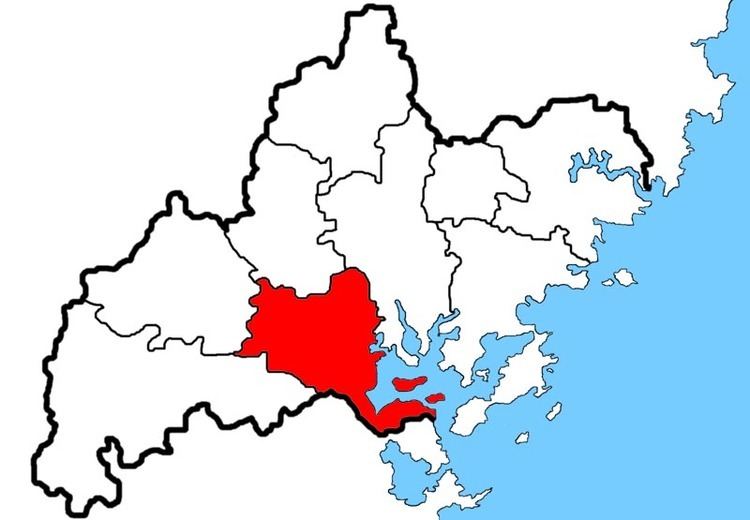
Jiaocheng (Chinese: 蕉城区; pinyin: Jiāochéng; Foochow Romanized: Ciĕu-siàng) is a district of Ningde, Fujian province, PRC. Also called Ningde Shiqu (宁德市区 - Ningde Centre), the district seats the municipality's executive, legislature and judiciary, together with its Communist Party and Public Security Bureau.
Contents
- Map of Jiaocheng Ningde Fujian China
- Situation
- Administration
- Subdistricts
- Development zones
- Towns
- Townships
- Transportation
- References
Map of Jiaocheng, Ningde, Fujian, China
Situation
Jiaocheng is bordered by Xiapu and Pingnan counties to the east and west, Zhouning County and Fu'an City to the north, and to the south by Fuzhou municipality's Gutian and Luoyuan counties. A large deep-water bay Sandu Ao gives access to the East China Sea.
Administration
The district oversees two Street committees (jiedao, 街道), one Development zone (kaifa-qu, 开发区), ten towns (zhen, 镇) and four townships (xiang, 乡), of which one is zoned Affirmative action-like for the native She people.
Subdistricts
Development zones
Towns
Townships
Transportation
Both Subdistricts, the Ethnic Township and the towns of Feiluan, Chengnan, Qidu and Badu lie on National Route 104, connecting south to Fengshan and north to Fu'an City centre.