
Country United States County Lincoln Incorporated (Jefferson) February 24, 1807 Elevation 85 m Population 2,427 (2010) | Settled (Ballstown Plantation) 1770 Time zone Eastern (EST) (UTC-5) Zip code 04348 Local time Friday 2:25 PM | |
 | ||
Weather -3°C, Wind NE at 3 km/h, 49% Humidity | ||
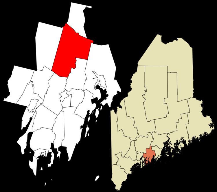
Jefferson is a town in Lincoln County, Maine, United States. The population was 2,427 at the 2010 census. Damariscotta Lake State Park, a popular Mid Coast swimming, canoeing and picnic area, is located within the town limits.
Contents
- Map of Jefferson ME 04348 USA
- History
- Geography
- 2010 census
- 2000 census
- Government
- Education
- Notable people
- References
Map of Jefferson, ME 04348, USA
History
Jefferson is a town in Lincoln County, incorporated on February 24, 1807, when Thomas Jefferson was President, from Ballstown Plantation. During the 19th Century, it set off land to Alna and Newcastle, and annexed land from Patricktown, later incorporated as Somerville.
Abandoned granite quarries and clay banks where bricks were made suggest the early economic activities of the area.
Geography
According to the United States Census Bureau, the town has a total area of 58.58 square miles (151.72 km2), of which, 52.57 square miles (136.16 km2) of it is land and 6.01 square miles (15.57 km2) is water. Jefferson is located on the Great Bay of Damariscotta Lake. Damariscotta Lake State Park is a 17-acre (69,000 m2) State Park located in Jefferson.
2010 census
As of the census of 2010, there were 2,427 people, 1,010 households, and 703 families residing in the town. The population density was 46.2 inhabitants per square mile (17.8/km2). There were 1,564 housing units at an average density of 29.8 per square mile (11.5/km2). The racial makeup of the town was 98.1% White, 0.3% African American, 0.5% Native American, 0.2% Asian, 0.1% from other races, and 0.7% from two or more races. Hispanic or Latino of any race were 1.5% of the population.
There were 1,010 households of which 28.2% had children under the age of 18 living with them, 57.2% were married couples living together, 8.2% had a female householder with no husband present, 4.2% had a male householder with no wife present, and 30.4% were non-families. 23.0% of all households were made up of individuals and 8.9% had someone living alone who was 65 years of age or older. The average household size was 2.39 and the average family size was 2.79.
The median age in the town was 46 years. 20% of residents were under the age of 18; 6.9% were between the ages of 18 and 24; 22.1% were from 25 to 44; 34% were from 45 to 64; and 17.1% were 65 years of age or older. The gender makeup of the town was 49.8% male and 50.2% female.
2000 census
As of the census of 2000, there were 2,388 people, 945 households, and 687 families residing in the town. The population density was 45.3 people per square mile (17.5/km²). There were 1,427 housing units at an average density of 27.1 per square mile (10.5/km²). The racial makeup of the town was 98.83% White, 0.08% African American, 0.04% Native American, 0.17% Asian, 0.13% from other races, and 0.75% from two or more races. Hispanic or Latino of any race were 0.34% of the population.
There were 945 households out of which 31.7% had children under the age of 18 living with them, 62.4% were married couples living together, 6.3% had a female householder with no husband present, and 27.2% were non-families. 21.2% of all households were made up of individuals and 9.1% had someone living alone who was 65 years of age or older. The average household size was 2.52 and the average family size was 2.91.
In the town, the population was spread out with 24.6% under the age of 18, 5.5% from 18 to 24, 28.7% from 25 to 44, 26.3% from 45 to 64, and 14.9% who were 65 years of age or older. The median age was 40 years. For every 100 females there were 97.4 males. For every 100 females age 18 and over, there were 98.6 males.
The median income for a household in the town was $42,311, and the median income for a family was $45,694. Males had a median income of $30,865 versus $25,430 for females. The per capita income for the town was $20,298. About 7.3% of families and 12.3% of the population were below the poverty line, including 17.4% of those under age 18 and 11.4% of those age 65 or over.
Government
Jefferson's government consists of a three-member Board of Selectmen, A Chair Selectman is chosen each year, this person oversees the monthly meetings. There is no Town Manager, a Town Clerk runs maintains the day-to-day operations.
Education
Jefferson has one K-8 public school and one public library. The Jefferson Village School is part of the [1]. High school students are allowed to go to any of the surrounding local high schools.