
First ascent Unknown Elevation 1,926 m | ||
 | ||
Similar Mount Zagora, Jbel Tidirhine, Tassemit, Jbel Kissane, Jbel Ayachi | ||
Jebel Kelti is a mountain in the Tanger-Tetouan-Al Hoceima region, Morocco. It is located south of Tetouan in Chefchaouen Province. This mountain is part of the Rif mountain chain.
Contents
Map of Jebel Kelti, Morocco
Description
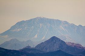
Jebel Kelti is about 1912 metres high. It is located between Tetouan and Chefchaouen in the Tangier-Tétouan region of Morocco. It is a good panoramic lookout of the region and can be seen from Spain as it is below Ceuta. It has a small summit area and steep sides.
Mount Kelti is a limestone mountain, one of the highest summits of the limestone dorsal of the Rif Range. There are some well-preserved cedar forests on its slopes.
References
Jebel Kelti Wikipedia(Text) CC BY-SA