
Country Canada Elevation 143 m Local time Friday 5:07 AM Number of airports 1 | Time zone Mountain (MST) (UTC-7) Population 64 (2011) Area code 867 | |
 | ||
Weather -32°C, Wind SE at 6 km/h, 76% Humidity | ||
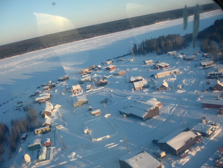
Jean Marie River (Slavey language: Tthek'éhdélį or Tthek'edeli "water flowing over clay") is a "Designated Authority" in the Dehcho Region of the Northwest Territories, Canada. The community is located on the Jean Marie River where it joins the Mackenzie River. The community has a small airport, Jean Marie River Airport, and is accessible by charter aircraft throughout the year and by the all-season JMR Access Road 27 kilometres (17 mi) from the Mackenzie Highway.
Contents
- Map of Jean Marie River NT Canada
- 18 permafrost vulnerability assessment in jean marie river fabrice calmels margaret ireland
- Demographics
- Services
- First Nations
- References
Map of Jean Marie River, NT, Canada
18 permafrost vulnerability assessment in jean marie river fabrice calmels margaret ireland
Demographics
As of the 2006 Census the population was 64, a decrease of 21.0% from the 2006 Census, the majority of which were First Nations. The main languages in the community are Dene Zhatie (South Slavey) and English. In 2012 the Government of the Northwest Territories reported that the population was 71.
Services
Royal Canadian Mounted Police services are provided through Fort Simpson. There is neither a hospital nor a health centre but a health station, the "Jean Marie Health Cabin," located in Jean Marie River. There is currently no grocery store, but there are accommodations and a visitors centre. Education is provided through the Louie Norwegian School and provides education up to Grade 10.
First Nations
The Dene of the community are represented by the Jean Marie River First Nation and belong to the Dehcho First Nations.