
Area code(s) +53-41-88xxxx Area 765 km² Population 42,708 (2004) | Time zone EST (UTC-6) Elevation 347 m Local time Thursday 11:24 PM | |
 | ||
Weather 20°C, Wind N at 8 km/h, 81% Humidity | ||
Jatibonico is a municipality and town in the Sancti Spíritus Province of Cuba.
Contents
Map of Jatibonico, Cuba
Demographics
In 2012, the municipality of Jatibonico had a population of 42,959. With a total area of 765 km2 (295 sq mi), it has a population density of 55.8/km2 (145/sq mi).
Catholic Parish Church
A gallery of stained glass windows can be found at Jatibonico's St. Joseph Catholic Parish Church, unique in its kind in the whole of Cuba.
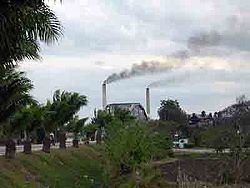
Jatibonico Oil Field
The Jatibonico Oil Field was discovered in the early 1950s by Grupo Jarueca after surface oil seeps were noticed in the area. Oil was discovered at a depth of about 1,100 feet in a marly shale within a structural high. This was the first new field discovered in the post-World War II era and the start of several more fields in the Central Basin of Cuba.
References
Jatibonico Wikipedia(Text) CC BY-SA