
Phone +1 804-646-8911 | ||
 | ||
Address 4301 Riverside Dr, Richmond, VA 23219, USA Hours Open today · Open 24 hoursSaturdayOpen 24 hoursSundayOpen 24 hoursMondayOpen 24 hoursTuesdayOpen 24 hoursWednesdayOpen 24 hoursThursdayOpen 24 hoursFridayOpen 24 hours Similar Profiles | ||
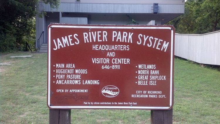
The James River Parks System (also known as James River Park or simply JRPS) is a 550-acre (220 ha) municipal park in Richmond, Virginia. It consists of multiple sections along the James River between the Huguenot Memorial Bridge in the west to a half mile (0.8 km) beyond the I-95 Bridge over the James in the east. It is a part of the city’s Department of Parks, Recreation and Community Facilities.
Contents
Safety in the james river park system
History
JRPS was formed by the City of Richmond in 1972 from a number of private properties that had been donated.
First Land Donation
The first property donated was a 380 acre tract obtained and donated to the city in 1966 by scout leader Charles Joseph “Joe” Schaefer. Schaefer had tried in vain to seek permission for his scouts to camp on a James River Island in 1965, and in the process, he and his former VMI roommate sought to find and secure a two-mile tract of river property to donate to the city as a public park.
Creation of the JRPS in 1972
Ralph White, a former Peace Corps volunteer and National Park Service employee, was hired by the City of Richmond in 1980 as one of several JRPS employees. At the time the river was not in very good condition, owing to littering and years of industrial use of the river White eventually became the manager of JRPS and spent a 32-year career with the city of Richmond, transforming JRPS through advocacy and engaging community groups in volunteer cleanups. In December 2012, White retired and was replaced by Nathan Burrell.
2009 Conservation Easement
In May 2009, a conservation easement was placed on parcels of the James River Park System. The Virginia Department of Conservation, the Capitol Region Land Conservancy and the EnRichmond Foundation (formerly the Richmond Recreation and Parks Foundation) are the conservation easement holders. This open space and conservation easement, in general, restricts all future development in each parcel, although it does allow for regular maintenance and replacement in kind by the City of Richmond’s Department of Parks, Recreation, and Community Facilities
Sections
The number of sections of the park have expanded over time. Some sources say there are currently 19 sections. From west to east, sections include the following areas: