
Population 1,171 Sovereign state United Kingdom Local time Saturday 5:17 AM | OS grid reference TQ0053 Post town Guildford Dialling code 01483 | |
 | ||
Weather 12°C, Wind W at 24 km/h, 90% Humidity | ||
Jacobs Well or Jacobswell is a small village in Surrey, England, of 20th century creation, with a population of 1,171. The village forms a northern outskirt of Guildford, in the civil parish of Worplesdon (where the 2011 Census population is included) which can be considered the mother village of medieval date to the west. The Stoke Hill part of Stringers Common, Slyfield Industrial Estate and a Surrey County Council general waste transfer station to the south form the narrowest of its buffer zones to all sides, separating the Slyfield part of Guildford from the village.
Contents
Map of Jacobs Well, Guildford, UK
Between Jacobs Well and Burpham to the south-east and east lie the River Wey, Burpham Court Farm Park, the River Wey Navigation, and the A3, in that order.
Other nearby settlements include Sutton Green (beyond which is Old Woking) to the NNE.
History
The farm of Burgham Court (now reflected in the farmhouse of Burpham Court) until the 20th century owned most of the land on the east side of the parish (which was a major source of poor relief and public works - see vestry). Outskirts of the land remain common land, which was the only main type of land not to have been owned by the lord of the manor. The manor was handed down via lines of the interconnected Wintershull/Wintershall, Bassett, Unwyn, Windsor, Wolley and Wroth family from Thurstan le Dispenser at the time of the Testa de Nevill into ultimately the major landholdings of the Earls Onslow in the 18th century, historically the Earl of Surrey who held it until the early 20th century.
Amenities
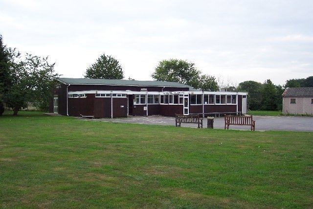
Aside from the green buffers to all sides, principally Whitmoor Common to the west, which is the largest, amenities include a scout hut and village hall. Guildford Spectrum, the largest leisure facility in Surrey, which is supported by local property rates, is on Parkway/Woodthorpe Road on the north side of Guildford.
A visitor attraction within these buffers is Sutton Place, in an outcrop of the borough of Woking, to the north and north-east, which was built in the Tudor period.
Religion
The nearest place of worship is by but not in the village, St Peter's Church. The denomination is Anglican.
Transport links
The village is on two significant through roads: the A320 from Guildford to Woking and the unclassified road that links Worplesdon to Burpham (and proceeds afterwards to Merrow and the A25).
The mainline railway between Woking and Guildford (the Portsmouth Direct Line) marks the practical boundary of the village to the west, however the nearest stations are Worplesdon and Guildford. The nearest of these, Worplesdon is 1.6 miles (2.6 km) point-to-point.
Jacobs Well in has more than hourly bus services to and from Guildford and Woking.
Boats are available for hire at Guildford Boatyard, and elsewhere, for use on the River Wey Navigation, which forms the effective boundary of the village to the east. Burpham Lock is centred 1 km to the east, accessible from Clay Lane, the road to Burpham.