Discharge 183 m³/s | Length 206 km Basin area 7,380 km² | |
 | ||
- average 183 m/s (6,000 cu ft/s) approx. | ||
J kuls fj llum glacial river
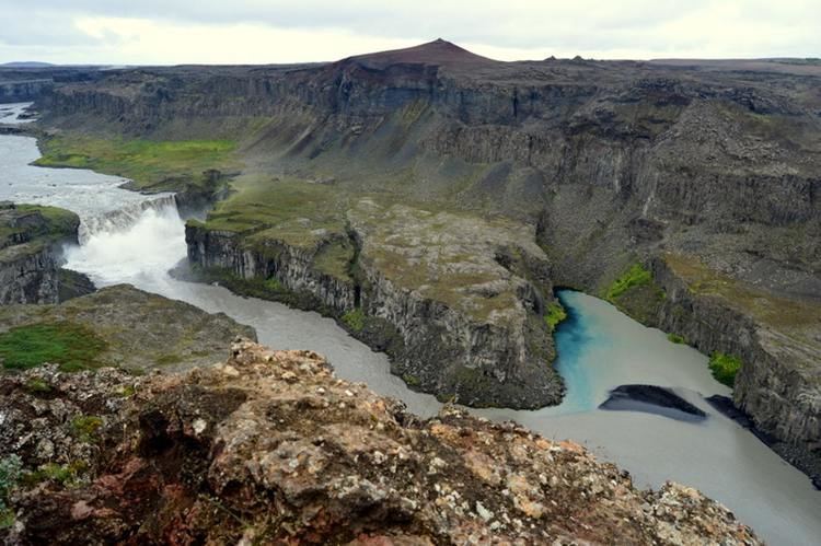
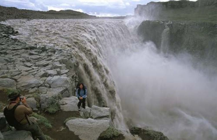
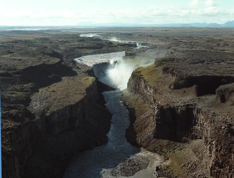
Jökulsá á Fjöllum ([ˈjœːkʏlsˌauː au ˈfjœtlʏm̥] glacial river in the mountains) is the second longest river in Iceland (206 km). Its source is the Vatnajökull glacier. It flows into the Greenland Sea. Jökulsá á Fjöllum streams over the waterfalls Selfoss, Dettifoss, and Hafragilsfoss, the second of which is the most powerful waterfall in Europe.
Contents
- J kuls fj llum glacial river
- Selfoss waterfall in the j kuls fj llum river in north iceland
- Glacial flooding
- References
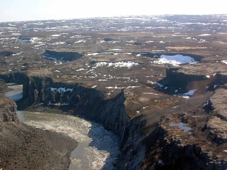
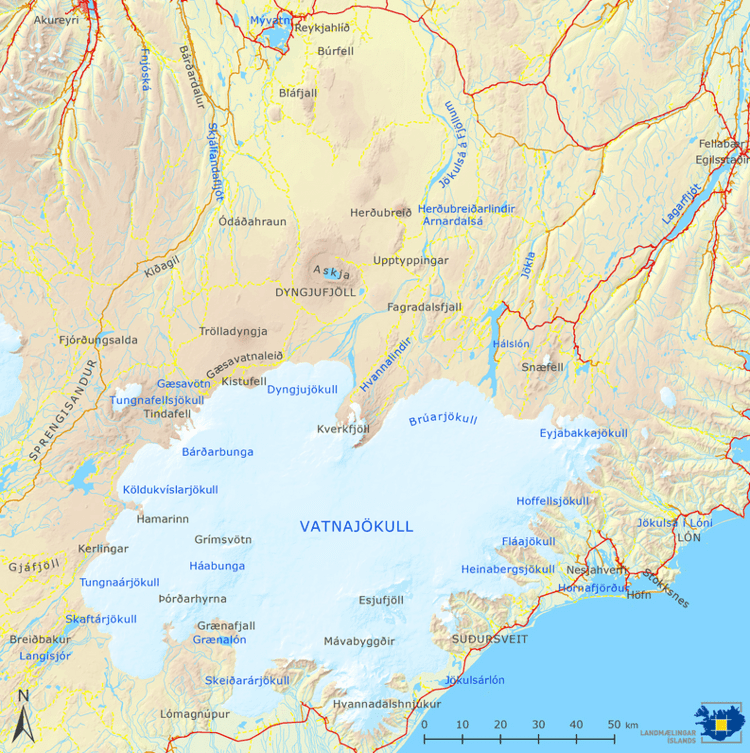
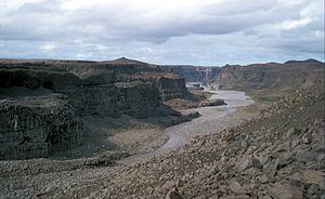
The source of the river is in the Vatnajökull National Park, one of three national parks in Iceland. The river is located in the northeast of Iceland and forms the eastern boundary of Ódáðahraun, an extensive lava field. Its drainage basin is the largest in Iceland at 7,380 square kilometers.
Selfoss waterfall in the j kuls fj llum river in north iceland
Glacial flooding
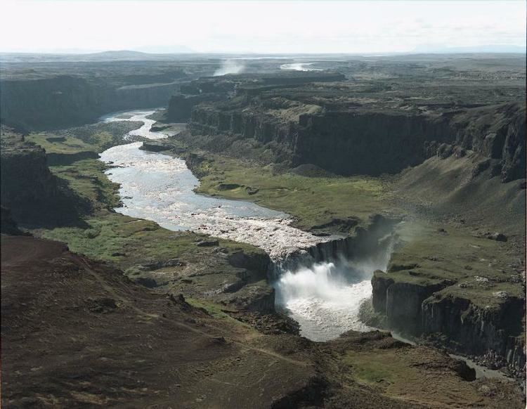
Dettifoss drops into the Jökulsárgljúfur canyon, a feature which, along with the Ásbyrgi gorge, appears to have been formed by catastrophic glacial flooding caused by volcanic activity. The volcano in question was possibly Bárðarbunga, which has been identified as posing the risk of a similar event in the future.
The largest jökulhlaups (glacial floods) in Iceland are known to have occurred along Jökulsá á Fjöllum between 7100 and 2000 yr BP. The source of these floods were likely eruptions of a major volcano under the Vatnajökull glacier, in the late Holocene. The peak discharge of this flood is estimated to have been 900,000 cubic metres per second (32,000,000 cu ft/s). This can be compared to the flow of the Amazon river, which has an average discharge of 209,000 cubic metres per second (7,400,000 cu ft/s).
The latest research concludes that the Jökulsárgljúfur canyon was formed by three flooding events. These key events occurred two, five and nine thousand years ago, separated by millennia of relative stability.