
Area 23.51 km² Local time Friday 8:02 PM | Region Kantō Population 155,674 (Feb 2010) | |
 | ||
Address 4636-2 Izumi-chō, Izumi-ku Yokohama-shi, Kanagawa-ken245-0016 Weather 9°C, Wind N at 18 km/h, 48% Humidity Points of interest Tennomoriizumi Park, Nakata Central Park, Shirayuri Park | ||
Izumi-ku (泉区) is one of the 18 wards of the city of Yokohama in Kanagawa Prefecture, Japan. In 2010 the ward had an estimated population of 155,674 and a density of 6,620 persons per km². The total area was 23.51 km².
Contents
- Map of Izumi Ward Yokohama Kanagawa Prefecture Japan
- Geography
- Surrounding municipalities
- History
- Economy
- Education
- Railroads
- Prefecture roads
- Noted people from Izumi
- References
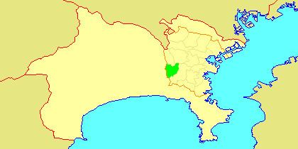
Map of Izumi Ward, Yokohama, Kanagawa Prefecture, Japan
Geography
Izumi Ward is located in eastern Kanagawa Prefecture, and on the central-western borders of the city of Yokohama. The area is largely flatland, with scattered small hills.
Surrounding municipalities
History
The area around present-day Izumi Ward has been inhabited continuously for thousands of years. Archaeologists have found stone tools from the Japanese Paleolithic period and ceramic shards from the Jomon period, and tombs from the Kofun period at numerous locations in the area. Under the Nara period Ritsuryō system, it became part of Kamakura and Kōza Districts in Sagami Province. In the Heian period, it was divided between shōen controlled by the Ōba clan and the Kamakura clan (of which Kamakura Gongorō Kagemasa was the most illustrious member). By the Kamakura period, much of the area was farmland supporting the population of nearby Kamakura. During the Edo period, the territory came under the control of Tokugawa Ieyasu. It was administered as tenryō territory controlled directly by the Tokugawa shogunate, but administered through various hatamoto.
After the Meiji Restoration, Izumi Ward became part of the new Kanagawa Prefecture in 1868. In the cadastral reform of April 1, 1889, the area was divided into numerous villages under Kamakura District. During the Meiji period, the area was a center for sericulture. On April 1, 1939, Izumi was annexed by the neighboring city of Yokohama, becoming part of Totsuka Ward. In a major administrative reorganization of October 1, 1969, Totsuka Ward was divided, and Izumi emerged as an independent ward within Yokohama.
Economy
Izumi Ward is largely a regional commercial center and bedroom community for central Yokohama and Tokyo. In 1996, in conjunction with the San Diego-Yokohama sister city relationship, Sotetsu Real Estate Co., Ltd. developed and constructed ten imported housing units, using construction documents and building materials from the United States, with a San Diego theme and style. The project was called San Diego Street of Dreams, in total, 30 such import housing units were constructed and still remain today in Ryokuentoshi, Izumi-ku.