
Country Japan Area 13.36 km² Local time Friday 8:04 PM | Population 76,913 (31 Mar 2013) | |
 | ||
Time zone Japan Standard Time (UTC+9) Weather 7°C, Wind N at 14 km/h, 66% Humidity Points of interest Izuanashi Shrine, Sukematsu Park, Anashi Park, Higashiminato Park, Fuei Sakaisenbokukoshiomi Park | ||
Izumiōtsu (泉大津市, Izumiōtsu-shi) is a city in Osaka Prefecture, Japan, founded on April 1, 1942.
Contents
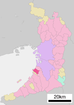
- Map of Izumiotsu Osaka Prefecture Japan
- Demographics
- Rail
- National highways
- Education
- Sister cities
- References
Map of Izumiotsu, Osaka Prefecture, Japan
Demographics
As of March 31, 2013, the city has an estimated population of 76,913, with 33,180 households and a population density of 5,757 persons per km². The total area is 13.36 km².
Rail
Izumiōtsu is served by the following three railway stations on the Nankai Main Line.
National highways
Education
The city previously had a North Korean school, Senshu Korean Elementary School (泉州朝鮮初級学校).
Sister cities
References
Izumiōtsu Wikipedia(Text) CC BY-SA