
Area 19,977 km² | ||
 | ||
Istmo de tehuantepec su gente su vida y yo
Istmo de Tehuantepec is the largest region in the state of Oaxaca, Mexico. It covers the southern part of the Isthmus of Tehuantepec, the shortest route between the Gulf of Mexico and the Pacific Ocean before the Panama Canal was opened. The region has two districts, Juchitán and Tehuantepec, with a total of 41 municipalities.
Contents
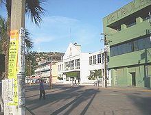
The region has cement and lime plants, but the main industry is the Pemex refinery in the port of Salina Cruz on the Pacific coast. The isthmus has extensive livestock production. Crops include sesame, coffee, rice, sorghum, pineapple, banana, coconut, melon and sugarcane. Fishing cooperatives harvest shrimp and other seafood from the Pacific.
The government has plans to develop the trans-isthmus corridor, including improving transportation routes, developing an industrial zone along the highway and expanding the petroleum and petrochemical industries in Salina Cruz. Other plans include creating coffee plantations and cattle corridors, expanding production of beans, maize and chili and exploiting the bio-genetic resources of native medicinal plants.
The region contains the largest part of the Selva Zoque, or Zoque Forest, an area of great ecological importance including the largest intact tropical rain forest in Mexico.