
 | ||
Isotopes and isoscapes tools for testing hydrological and biogeochemical models
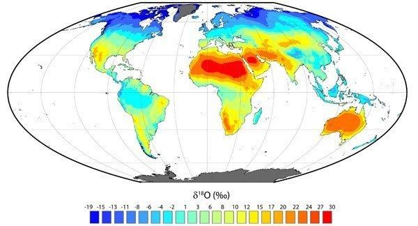
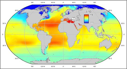
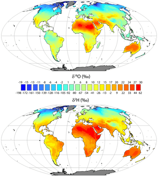
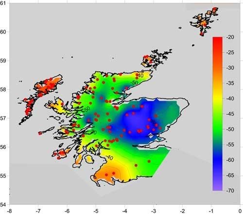
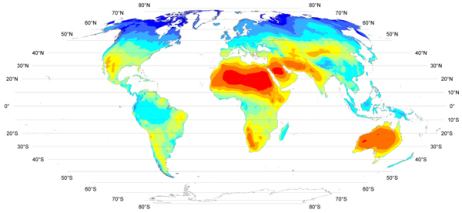
Isoscapes are spatially explicit predictions of elemental isotope ratios (δ) that are produced by executing process-level models of elemental isotope fractionation or distribution in a Geographic Information System (GIS). The word isoscape is derived from isotope landscape and was first coined by Dr. Jason B. West. Isoscapes of hydrogen, carbon, oxygen, nitrogen, and strontium have been used to answer scientific or forensic questions regarding the sources, partitioning, or provenance of natural and synthetic materials or organisms via their isotopic signatures. These include questions about migration, Earth's element cycles, human water use, climate, archaeological reconstructions, forensics, and pollution.
Contents
- Isotopes and isoscapes tools for testing hydrological and biogeochemical models
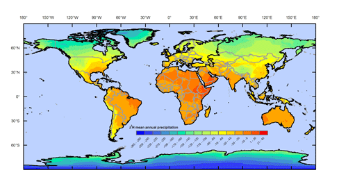
- Precipitation isoscapes h daily
- References
Precipitation isoscapes h daily
References
Isoscapes Wikipedia(Text) CC BY-SA