
Province Province of Cádiz | ||
 | ||
Similar Bahía de Cádiz Natural P, Bay of Cádiz, Paraje natural Cola del, Punta del Boquerón, José Leon de Carranza | ||
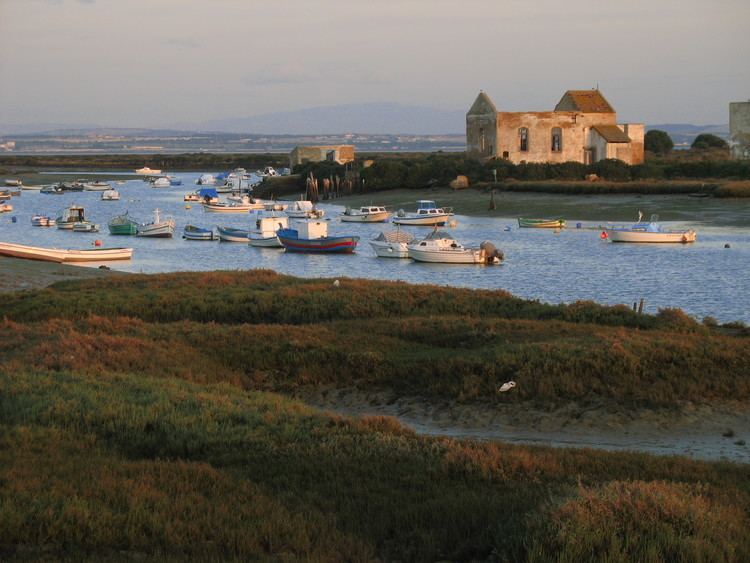
Isla del Trocadero is an island in the Bay of Cádiz, in Andalusia, Spain.
Contents
- Map of Isla del Trocadero 11519 CC3A1diz Spain
- Situation
- Protected area
- Access to the island
- History
- References
Map of Isla del Trocadero, 11519, C%C3%A1diz, Spain
Situation
The island has an area of 5.25 km² and lies in Southern part of the Bay of Cádiz, Southwest of Puerto Real village.
The North of the island is crossed by Spanish National highway N443, which goes from Puerto Real to Cádiz. The industrial area Polígono El Trocadero and the ramp in the National highway named El Trocadero refer to the direct proximity of the island.
Protected area
The Isla del Trocadero belongs to large protected area and a natural park (Parque Natural de la Bahía de Cádiz), with an extension of 100 km². The area is an important damp biotope and landing zone for migratory birds.
Access to the island
The island can be accessed by the ports of Puerto Real and Matagorda. It is particularly interesting for bird watching.
History
The island has been an important commercial traffic point for a long time. It was also used to repair ships. The San Luis Fort, in the Southern tip of the island, was used as part of the defences of the Bay of Cádiz.
The fort, currently in ruins, was captured by French troops during the Battle of Trocadero, on August 31, 1823.