
 | ||
Similar Salar de Uyuni, Árbol de Piedra, Tunupa, Laguna Colorada, Laguna Verde | ||
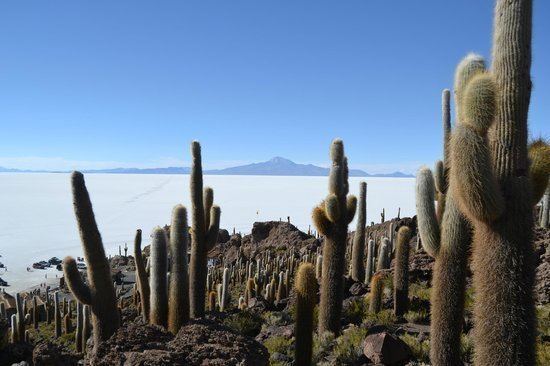
Panaramic of el salar de uyuni from isla incahuasi bolivia
Isla Incahuasi, Inkawasi or Inka Wasi (Quechua Inka Inca, wasi house, "Inca house") is a hilly and rocky outcrop of land and former island in Bolivia situated in the middle of Salar de Uyuni, the world's largest salt flat, at an elevation of 3,656 meters (11,995 feet). It is located in the Potosí Department, Daniel Campos Province, Tahua Municipality, Yonza Canton. Isla Incahuasi is the Spanish name where isla means island, Inca stands for Inca, and huasi is derived from the Quechua word wasi meaning house.
Contents
- Panaramic of el salar de uyuni from isla incahuasi bolivia
- Map of Isla Incahuasi Bolivia
- Salar de uyuni isla pescado isla incahuasi
- References
Map of Isla Incahuasi, Bolivia
Incahuasi has a total area of 24.62 hectares (61 acres) and hosts gigantic cacti (Trichocereus pasacana) and a tourist center. There are unusual and fragile coral-like structures and deposits that often consist of fossils and algae. The place is the top of the remains of an ancient volcano, which was submerged when the area was part of a giant prehistoric lake, roughly 40,000 years ago.