
FIPS code 55-37150 Elevation 286 m Local time Wednesday 11:58 AM | Time zone Central (CST) (UTC-6) GNIS feature ID 1566971 Population 911 (2013) | |
 | ||
Weather -3°C, Wind NW at 18 km/h, 42% Humidity Area 179 ha (176 ha Land / 3 ha Water) | ||
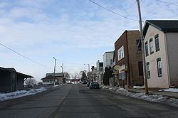
Iron Ridge is a village in Dodge County, Wisconsin, United States. The population was 929 at the 2010 census. The village was founded on a railroad line, named for the iron mined in the area. Its ZIP code is 53035.
Contents
- Map of Iron Ridge WI 53035 USA
- Geography
- 2010 census
- 2000 census
- St Matthew Lutheran Church
- Zum Kripplein Christi Evangelical Lutheran Church
- Our Saviors Lutheran Church
- Butler Ridge Wind Farm
- References
Map of Iron Ridge, WI 53035, USA
Geography
Iron Ridge is located at 43°23′57″N 88°31′52″W (43.399155, -88.530996).
According to the United States Census Bureau, the village has a total area of 0.69 square miles (1.79 km2), of which, 0.68 square miles (1.76 km2) of it is land and 0.01 square miles (0.03 km2) is water.
2010 census
As of the census of 2010, there were 929 people, 390 households, and 234 families residing in the village. The population density was 1,366.2 inhabitants per square mile (527.5/km2). There were 409 housing units at an average density of 601.5 per square mile (232.2/km2). The racial makeup of the village was 96.9% White, 0.5% African American, 0.3% Native American, 0.1% Asian, 1.6% from other races, and 0.5% from two or more races. Hispanic or Latino of any race were 3.1% of the population.
There were 390 households of which 30.0% had children under the age of 18 living with them, 44.1% were married couples living together, 9.2% had a female householder with no husband present, 6.7% had a male householder with no wife present, and 40.0% were non-families. 31.0% of all households were made up of individuals and 10% had someone living alone who was 65 years of age or older. The average household size was 2.38 and the average family size was 3.00.
The median age in the village was 38.3 years. 22.9% of residents were under the age of 18; 8.4% were between the ages of 18 and 24; 28.8% were from 25 to 44; 30.6% were from 45 to 64; and 9.4% were 65 years of age or older. The gender makeup of the village was 51.8% male and 48.2% female.
2000 census
As of the census of 2000, there were 998 people, 360 households, and 245 families residing in the village. The population density was 1,402.6 people per square mile (542.7/km²). There were 383 housing units at an average density of 538.3 per square mile (208.3/km²). The racial makeup of the village was 99.00% White, 0.40% Native American, 0.30% from other races, and 0.30% from two or more races. Hispanic or Latino of any race were 1.00% of the population.
Just over 70% of the population report that their ancestors were from Germany.
There were 360 households out of which 42.2% had children under the age of 18 living with them, 57.8% were married couples living together, 6.9% had a female householder with no husband present, and 31.7% were non-families. 26.9% of all households were made up of individuals and 9.4% had someone living alone who was 65 years of age or older. The average household size was 2.77 and the average family size was 3.45.
In the village, the population was spread out with 34.0% under the age of 18, 8.5% from 18 to 24, 33.5% from 25 to 44, 15.6% from 45 to 64, and 8.4% who were 65 years of age or older. The median age was 30 years. For every 100 females there were 100.0 males. For every 100 females age 18 and over, there were 97.3 males.
The median income for a household in the village was $42,083, and the median income for a family was $50,893. Males had a median income of $36,359 versus $23,906 for females. The per capita income for the village was $16,214. About 1.7% of families and 3.4% of the population were below the poverty line, including 3.7% of those under age 18 and 2.6% of those age 65 or over.
St. Matthew Lutheran Church
St. Matthew Lutheran Church was founded in 1885.
Zum Kripplein Christi Evangelical Lutheran Church
This is a long-established Lutheran congregation, started by German immigrants in 1848. Zum Kripplein Christi is a member-congregation of the Wisconsin Evangelical Lutheran Synod.
This little congregation still uses its German name which means "At the Little Crib of Christ." While some speculation is given to how the congregation received its name, there is thought to be a connection with a congregation in Germany of the same name. That original congregation was the result of persecution by Prussian ruler John Sigismund, when devout Lutherans refused fellowship with the Reformed Church. The church building was seized, and members to forced to worship in a log cabin. Being a rather rough-looking sanctuary for worship, the pastor inspired his members by pointing out that even Jesus Christ was born in a stable. The church's school Zum Krippen Christi Lutheran Elementary School was closed in July 2006 due to declining attendance.
The cemetery of the same name is located in nearby Herman.
Our Savior's Lutheran Church
Our Savior's Lutheran Church was formed in 1975 by former members of St. Matthew Lutheran Church that were against church teachings in the Wisconsin Evangelical Lutheran Synod. This small, yet large in spirit congregation is known as "the little white church on the corner, the friendliest place to be every Sunday morning". The congregation gathers for worship at 9:00 on Sunday mornings
Our Savior's Lutheran Church is affiliated with the Evangelical Lutheran Church in America. As such, Our Savior's practices open communion.
The congregation as of May 2013 has 78 members. Following each week's worship service, all gather in the fellowship hall for conversation and a light meal. Sunday School for the children is held on the first Sunday of the month at 10:15am.
The congregation is led by Elaine Gerth, a lay-minister in the ELCA.
Butler Ridge Wind Farm
Iron Ridge is the community in Dodge County closest to the Butler Ridge Wind Farm, a wind farm that contains 36 turbines that are 300 feet wide and 260 feet tall. It sits along the Niagara Escarpment, a ridge that originates in Ontario, runs through Wisconsin, and ends in Illinois. It was initially developed by Midwest Wind Energy, and then acquired by Babcock & Brown, which carried it through construction. After Babcock & Brown's liquidation in 2009, the wind farm was acquired by NextEra Energy Resources. Part of the power is sold to WPPI Energy.