Location Michigan | Use Hiking/Biking | |
 | ||
Length 1,259 miles (hiking)774 miles (biking) Trailheads North: IronwoodSouth: Belle Isle Website DNR: Michigan's Iron Belle Trail Similar Border to Border Trail, Macomb Orchard Trail, Michigan Air Line Trail | ||
What is the iron belle trail
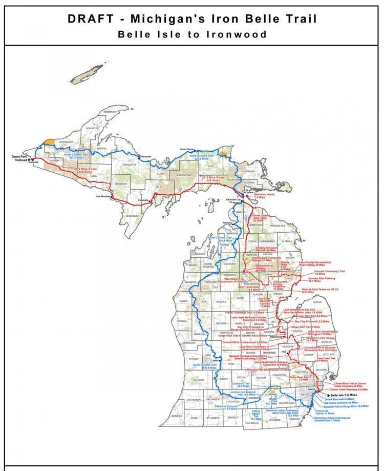
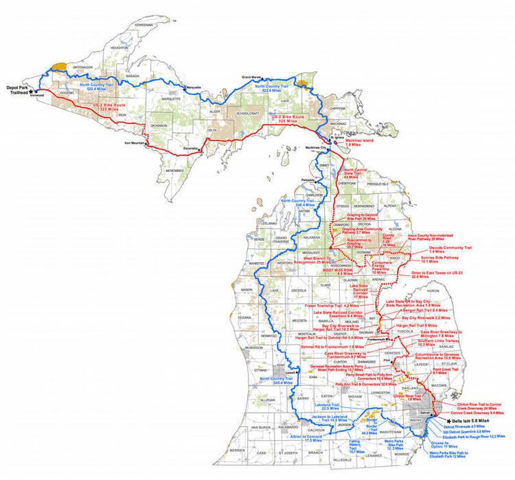
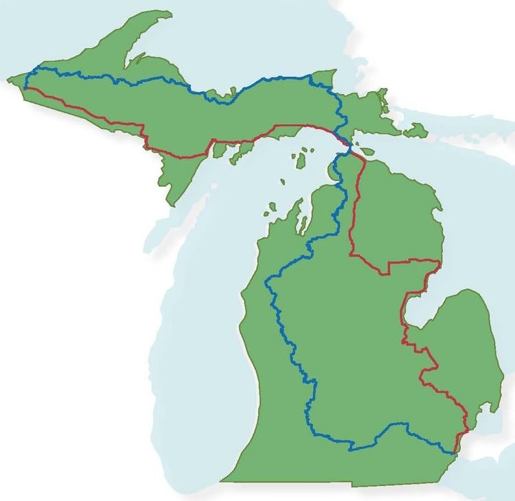
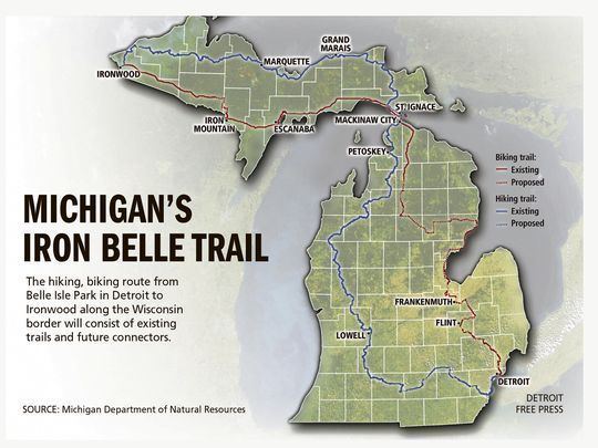
The Iron Belle Trail is a set of two trails that will span the state of Michigan. The two trails, one for hiking and one for biking, will go between Ironwood in the Upper Peninsula and Belle Isle State Park in Detroit. When complete, the hiking trail will be 1,259 miles (2,026 km) long and the biking trail will be 774 miles (1,246 km) long. The Michigan Department of Natural Resources is coordinating the planning and construction of the missing trail segments.
Contents
- What is the iron belle trail
- October 4 2016 hamburg township board discusses iron belle trail study
- Routes
- References
October 4 2016 hamburg township board discusses iron belle trail study
Routes
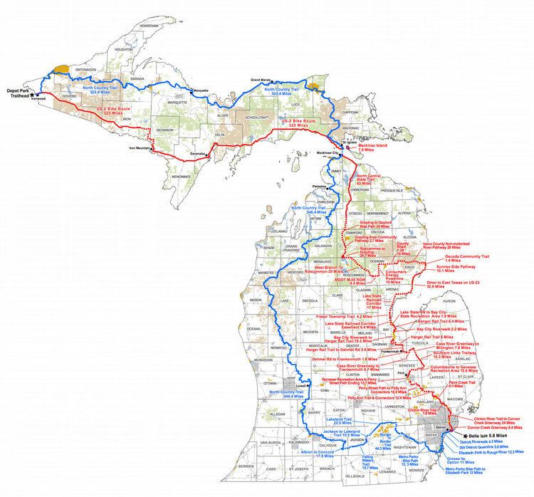
The hiking trail will primarily follow the Michigan segment of the North Country National Scenic Trail with connectors to Belle Isle and Ironwood.
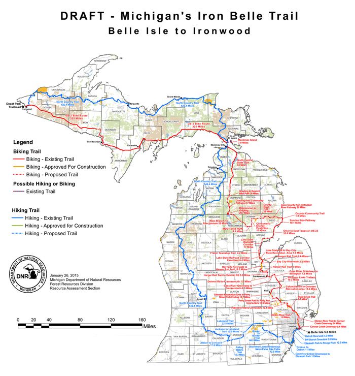
The biking trail will follow multiple new trails plus existing trails including the Paint Creek Trail in Oakland County, the North Central State Trail between Gaylord and Mackinaw City, and U.S. Bicycle Route 10 in the Upper Peninsula parallel to U.S. Highway 2 between St. Ignace and Ironwood.