Max. length 480 km (300 mi) | Surface area 776,997 km² | |
 | ||
Rv armstrong irminger sea 2016
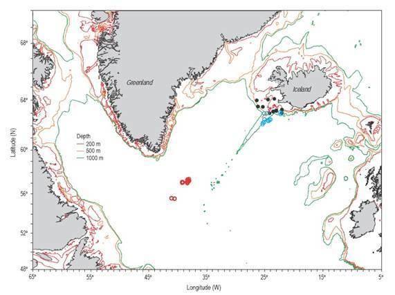
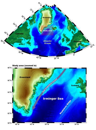
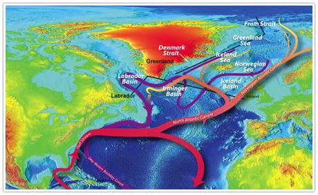
The Irminger Sea is a marginal sea of the North Atlantic Ocean. It is 480 km long and 290 km wide at its narrowest. The northern limit is the Greenland-Iceland Rise on the bottom of the Denmark Strait between Iceland and East Greenland, which connects to the Greenland Sea. To the southwest, it reaches to Cape Farvel, the southern tip of Greenland, and meets the Labrador Sea at this point. South of this point is the open North Atlantic Ocean. The sea floor of the Irminger Sea is largely part of the Irminger Basin, a northeastern continuation of the maximally 4600 m deep Labrador Basin, which on the east is bordered by the Reykjanes Ridge. This delineation is oceanographic only and does not represent any official borders. The Irminger Sea is one of the main fishing areas of the Rose fish.
Contents
- Rv armstrong irminger sea 2016
- Redfish fishing and production on russian vessel at irminger sea
- References
The Irminger Sea was named after Danish vice-admiral Carl Ludvig Christian Irminger (1802–1888), after whom also the Irminger Current was named.
Redfish fishing and production on russian vessel at irminger sea