
First listed on NRHP November 29, 1979 Total length 18 m Area 404.7 m² Architectural style Truss bridge | Built 1954 First de-listed May 15, 1989 Opened 1954 Body of water Oak Creek | |
 | ||
MPS Oregon Covered Bridges TR NRHP Reference # 13000117(previously 79002039) Address Midge Cramer Path, Corvallis, OR 97330, USA Bridge type Truss bridge, Covered bridge Similar Covered bridge, Rock O' the Range Bridge, Gallon House Bridge, Cedar Crossing Bridge, Pengra Bridge | ||
Flood waters under the irish bend covered bridge
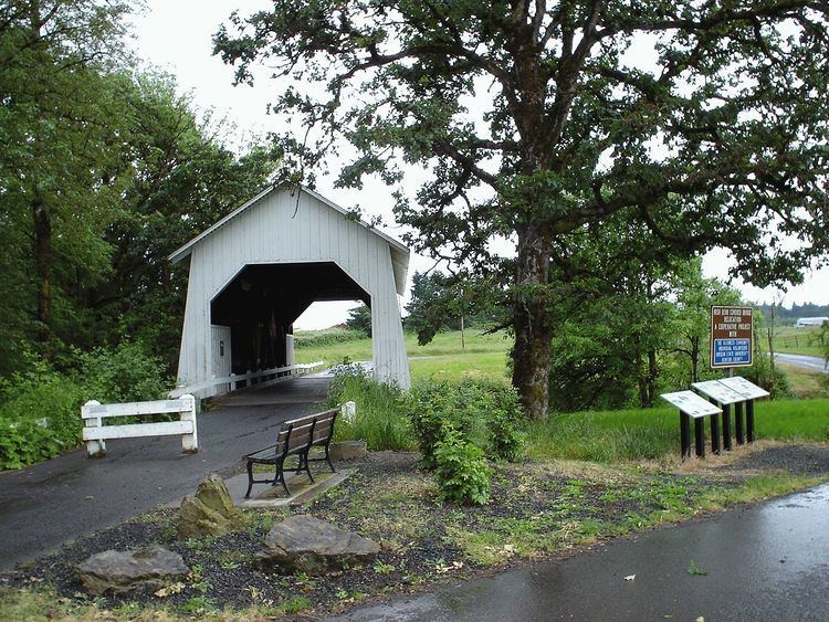
Irish Bend Covered Bridge is a wooden covered bridge near Corvallis, Oregon, United States. It was constructed in 1954 and originally spanned the Willamette Slough on Irish Bend Road near Monroe. However, in 1975 Irish Bend Road was realigned and the bridge fell into a state of disrepair. The bridge was added to the National Register of Historic Places in 1979. It was eventually dismantled in 1988 to make way for a more modern concrete span. Through negotiations with Benton County and Oregon State University (OSU), an agreement was reached to reconstruct the bridge on university property. $30,000 was raised by the Irish Bend Advisory Committee, and Benton County provided an additional $30,000 to fund the project, which was completed in 1989. Due to the relocation, the bridge was removed from the National Register in 1989. It was relisted in 2013.
Contents
- Flood waters under the irish bend covered bridge
- Flood waters by the irish bend covered bridge
- References
Today, the bridge is part of a path through the research farm between 35th and 53rd Streets on the west side of the OSU campus, spanning Oak Creek. Although the property is owned by the university, maintenance is carried out by the Benton County Parks Department.