
Country Tanzania Capital Iringa Postcode 51xxx Area 35,743 km² Area code 026 | Zone Southern Highlands Time zone EAT (UTC+3) Website iringa.go.tz Population 941,238 (2012) | |
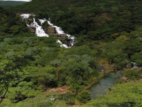 | ||
Colleges and Universities Tumaini University Makumira, Mkwawa University College of Education Points of interest Ruaha National Park, Sanje Falls, Udzungwa Mountains, Magic Site Mkwawa | ||
Iringa is one of Tanzania's thirty administrative regions. The regional capital is Iringa. The region's population is 941,238. It is primarily agricultural and boasts the second-highest per-capita GDP in the country.
Contents
- Map of Iringa Region Tanzania
- Geography
- Demographics
- Administration and politics
- Economy
- Agriculture
- Industry
- References
Map of Iringa Region, Tanzania
Iringa Region is home to Ruaha National Park, Tanzania's second largest park, which has an abundance of wildlife.
The Regional Commissioner of the Iringa Region is Amina Mesenza.
Geography
Iringa region has a total area of 35,743 square kilometres (13,800 sq mi). (Socio-economic profile:3) It is surrounded by Singida and Dodoma in the north, Morogoro to its west, Mbeya to its east and Njombe towards the south.(Socio-economic profile:1)
The region is drained by the Little Ruaha and the Great Ruaha rivers. The lake created by the Mtera Dam is the other significant water body here.(Socio-economic profile:3)
The region can be divided into three zones - highland, midland and lowland. The highland zone is towards the east of the region. This area experiences a rainy season between November and May with annual precipitation ranging from 500–1,500 mm (20–59 in). The period between June and September is cold and dry. The midland zone, in the central part of the region, lies at a height of 1,200–1,600 m (3,900–5,200 ft) above sea level and faces between 600–1,000 mm (24–39 in) of rain every year. Finally, the lowland zone, at a height of 900–1,200 m (3,000–3,900 ft) gets between 500–600 mm (20–24 in) of rain per annum.(Socio-economic profile:9-11)
About 16% of the land in Iringa region is forested.(Socio-economic profile:103) The region is host to the Ruaha National Park, famous for its large herd of elephants and over 400 species of birds. Other animals include lions, sable antelopes and kudu.(Socio-economic profile:112-113) A second park, Udzungwa Mountains National Park in Iringa Rural District, is less visited.
Demographics
Iringa region has a total population of 941,238.
Hehe people are the largest ethnic group living here. Other major populations are those of Bena and Kinga groups. Pangwa, Chaga, Nyakyusa and Ngoni can be found in urban areas primarily engaged in business. Maasai and Barbaig, sukuma and groups are mostly engaged in animal herding.(Socio-economic profile:12)
The region has one of the lowest growing populations in Tanzania.(Socio-economic profile:13) A major reason for this is persistent emigration from this region to more urban areas such as Dar es Salaam.(Socio-economic profile:28)
Administration and politics
The region is administratively divided into three district councils, one municipal council, and one town council as listed in the table:
Iringa region elects seven representatives to the National Assembly of Tanzania. In the 2015 general election, six candidates from the ruling Chama Cha Mapinduzi and one from CHADEMA won their respective seats. William Lukuvi, the MP for Ismani is the Cabinet Minister for Lands, Housing and Human Settlements Development.
Amina Mesenza is the Regional Commissioner of the region as of June 2016.
Njombe Region was split off from Iringa in March 2012.
Economy
Iringa region has the fifth largest GDP out of the 30 regions in Tanzania. On a per-capita basis, Iringa's 2012 figure of about TSh 1,400,000 ranks it second only to Dar es Salaam Region which includes the capital of Tanzania.
Agriculture
Agriculture is the mainstay of Iringa's economy accounting for 85% of its GDP.(Socio-economic profile:30) Between 2008 and 2011, an average 345,000 hectares (1,330 sq mi) of land was planted with food crops annually. Maize is the dominant cereal with about 245,000 hectares (950 sq mi) of land devoted to it. Beans are second most important food crop being grown on 56,000 hectares (220 sq mi). Cash crops take about 56,000 hectares with sunflower being the major output.(Socio-economic profile:57-60)
Industry
The industry in Iringa region is mostly small scale concentrated in Iringa municipality. Grain milling, carpentry and oil processing comprise the bulk of industrial units.(Socio-economic profile:123)