
Prominence 260 m (850 ft) Elevation 694 m | Isolation 14.9 km (9.3 mi) Easiest route Trail | |
 | ||
Similar Lägern, Üetliberg, Pfannenstiel, Bachtel, Schnebelhorn | ||
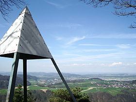
The Irchel is an elevation in the Canton of Zürich, located at the Rhine between the Töss and Thur rivers, on the territory of Buch am Irchel, Berg am Irchel and Freienstein-Teufen, separating the Andelfingen and Bülach districts. It is an outlying ridge of the Jura, rising to 694 m, lying east of the Lägern. Historically, it was part of the Germanic Limes. The name is from a Helvetic word for "stag".
Map of Irchel, 8414 Buch am Irchel, Switzerland
peaks:
References
Irchel Wikipedia(Text) CC BY-SA