
Established 1835 Population 17,235 (2016) | Incorporated April 17, 1879 Area 3,830 km² Area code 902 | |
 | ||
Points of interest Canso Canal, Gampo Abbey, The Cabot Trail, Skyline Trail, Whale Interpretive Centre Destinations | ||
Inverness County is a county in the Canadian province of Nova Scotia. Its territory is almost contiguous with the Municipality of Inverness County, which only excludes the town of Port Hawkesbury and Mi'kmaq reserves.
Contents
Map of Inverness County, NS, Canada
History
Established as the County of Juste au Corps in 1835, Inverness County was given its present name in 1837. It was named after Inverness in Scotland, the land from which many of the early settlers came. Agriculture and fishing dominated the economy with exports of butter and cattle to Newfoundland and Halifax for most of the nineteenth century. The construction of the Inverness and Richmond Railway in 1901, and the subsequent opening of coal mines at Port Hood, Mabou, and Inverness, created the "only home market" local farmers had ever had.
The boundaries of Inverness County had been previously defined when Cape Breton Island was divided by statute into three districts in 1823. In 1996, the county was amalgamated into a single municipality with the exception of Port Hawkesbury.
Inverness County was established within the boundaries of the Northwestern District of Cape Breton Island.
Demographics
As a census division in the 2016 Census of Population conducted by Statistics Canada, Inverness County recorded a population of 17,235 living in 7,351 of its 9,876 total private dwellings, a change of 2999600000000000000♠−4% from its 2011 population of 17,947. With a land area of 3,831.17 km2 (1,479.22 sq mi), it had a population density of 4.5/km2 (11.7/sq mi) in 2016.
Forming the majority of the Inverness County census division, the Municipality of the County of Inverness recorded a population of 13,190 living in 5,740 of its 8,052 total private dwellings in the 2016 Census of Population, a change of 2999570000000000000♠−4.3% from its 2011 population of 13,781. With a land area of 3,815.59 km2 (1,473.21 sq mi), it had a population density of 3.5/km2 (9.0/sq mi) in 2016.
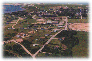
Communities
Access routes
Highways and numbered routes that run through the county, including external routes that start or finish at the county limits: