
Width 6.3 km (3.91 mi) | Length 1.9 km (1.18 mi) Municipality Qaasuitsup | |
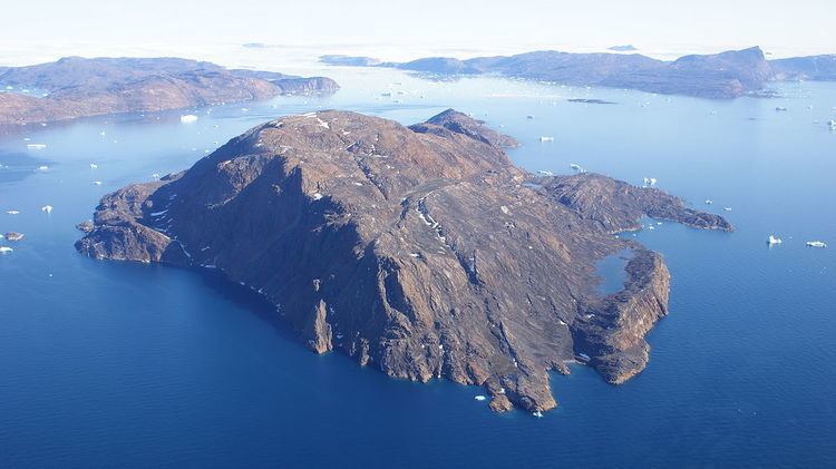 | ||
Inussulissuaq Island (old spelling: Inugsuligssuaq) is a small uninhabited island in the Melville Bay region of the Upernavik Archipelago in the Qaasuitsup municipality in northwestern Greenland. The name of the island means "a large cairn" in the Greenlandic language.
Contents
Map of Inussullissuaq Island, Greenland
Geography
Inussulissuaq Island is located in the northern part of Inussulik Bay, approximately 6 km (3.7 mi) south of Kiatassuaq Island, and 8.5 km (5.3 mi) west of the mainland Sanningassorsuaq Peninsula. There is a small freshwater lake on the southern coast. The highest point on the island is an unnamed summit at 560 m (1,840 ft).
History
Inussullissuaq Island has never been permanently inhabited due to its small size. In 1930 it briefly served as a polar station for Knud Rasmussen, the Greenlandic polar explorer and anthropologist. The station was named Bjørne Borg (or Bjørneborg, a bear castle). Its ruins can still be found on the island.
Settlement
Kullorsuaq is the closest settlement to the island, located on an island of the same name to the north of Kiatassuaq Island, 19.6 km (12.2 mi) away. In the south, the Nuussuaq village on the southern coast of Nuussuaq Peninsula is located 33.4 km (20.8 mi). The island is accessible only by boat, and thus the distances to reach it are longer due to the need to navigate around the Kiatassuaq Island and Nuussuaq Peninsula, respectively.