
Existed: mid-1960s – present Length 15.37 km | ||
 | ||
North end: NY 7 / NY 787 in Green Island | ||
Interstate 787 (I-787) is an auxiliary Interstate Highway in the U.S. state of New York. I-787 is the main highway for those traveling into and out of downtown Albany. The southern terminus is at the toll plaza for New York State Thruway (I-87) exit 23 southwest of downtown Albany. The northern terminus of the route is unclear, with some sources placing the terminus at 8th Street in Troy, creating an overlap with New York State Route 7 (NY 7) between Green Island and Troy. Other documents show I-787 as terminating at its interchange with NY 7 and NY 787 in the town of Colonie. Regardless, the route is 10.16 miles (16.35 km) long if extended to Troy, or 9.55 miles (15.37 km) excluding the NY 7 overlap.
Contents
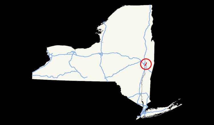
Map of I-787, New York, USA
North of NY 7, the right-of-way of I-787 continues north as NY 787 to the city of Cohoes.
Route description
I-787 officially begins at the toll barrier for I-87/Thruway exit 23; however, a short 0.57-mile (0.92 km) spur between U.S. Route 9W (US 9W) and the interchange connecting I-787 to the Thruway, designated as NY 912S, an unsigned reference route, is signed as I-787. At the east end of the interchange (exit 1) with I-87, I-787 northbound merges with NY 912S, progressing due east for a short distance before curving to the northeast ahead of the Delaware and Hudson Railway mainline near exit 2 (NY 32). Past NY 32, I-787 parallels the Hudson River as it heads northward into the heart of downtown Albany, featuring a pair of exits with US 9 and US 20 at a massive interchange southeast of the Empire State Plaza on the west bank of the Hudson.
North of downtown Albany, I-787 interchanges with I-90 at exit 5 prior to crossing into Menands and meeting NY 32 once more at exit 6 by way of a trumpet interchange. The ramp from the trumpet to NY 32, a 0.28-mile (0.45 km) long roadway, is designated as unsigned NY 913T. Farther north in Menands, I-787 intersects NY 378 (exit 7) by way of a near-cloverleaf interchange. In Watervliet, I-787 has one interchange with 23rd Street (exit 8) before reaching another near-cloverleaf interchange with NY 7 and NY 787 (exit 9) in Green Island. From this point, I-787's alignment becomes uncertain.
Northern terminus
The northern terminus of I-787 is unclear. Appendix E of the 2008 New York State Department of Transportation (NYSDOT) Traffic Data Report places the terminus at 8th Street in Troy, creating an overlap with NY 7 across the Hudson River via the Collar City Bridge. Additionally, there are shields for I-787 on the Collar City Bridge east of the Hudson River. Other sources, including the National Highway System map of Albany published by the Federal Highway Administration and NYSDOT's official description of signed routes in New York State, identifies the terminus as the NY 7 / NY 787 interchange near Green Island. Contemporary maps of the Albany area also lack I-787 shields on the Collar City Bridge, signing the roadway only as NY 7.
According to the NYSDOT traffic counts, I-787 is 10.16 miles (16.35 km) long; by limiting I-787 to the section between the Thruway and NY 7, the length is reduced to 9.55 miles (15.37 km).
History
Construction began in the early 1960s on the first segment of I-787 from I-87 to Bassett Street. It was completed and opened to traffic in the mid-1960s. By 1968, construction had begun on the remainder of I-787 south of Watervliet. The portion of the highway between I-90 and NY 378 was completed by 1971; the rest of I-787 south of 23rd Street in Watervliet was built and open to traffic by 1973. The ramps from the South Mall Arterial were opened in 1974. An extension of the freeway north to Arch Street near Green Island was completed by 1977. By 1980, the majority of modern exit 9 was completed even though the Collar City Bridge and the "Alternate Route 7" freeway had yet to be constructed. The Collar City Bridge over the Hudson River was built in 1981, connecting the pre-existing ramps at exit 9 to downtown Troy.
When I-787 was first planned, its northern terminus was at US 4 in Troy. On January 1, 1970, the I-787 designation was truncated westward to what is now exit 9 near Green Island while the then-proposed Collar City Bridge became (albeit on paper) part of I-88, a new highway extending from Binghamton to Troy by way of the Susquehanna Expressway and Alternate Route 7. The extension of I-88 never materialized as Alternate Route 7 ended up becoming a realignment of NY 7 when it was completed in the 1980s.
In 2005, an elevated section of the northbound exit 3 off ramp slipped off its supports, causing temporary closure of the ramp and causing disruption of the flow of traffic into the Empire State Plaza. The ramp connects I-787 with the South Mall Arterial. Initially, most roads and ramps near or under the elevated highway were closed, but once temporary piers were in place, most roads reopened. A detour was set up to allow northbound traffic to enter the Plaza, but it required crossing the Hudson River over the Dunn Memorial Bridge and traveling through the city of Rensselaer to get back on the bridge, allowing access into the Plaza. The slip caused the south end of a simple span of the overpass to drop about 2 feet (0.6 m). The pier stands 80 feet (24.4 m) tall at the slippage point. Nobody was hurt, but the woman who discovered the drop was shaken.'