
North end: US 41 in Chicago | Length 473.8 km | |
 | ||
South end: I-55 / I-64 / US 40 at East St. Louis | ||
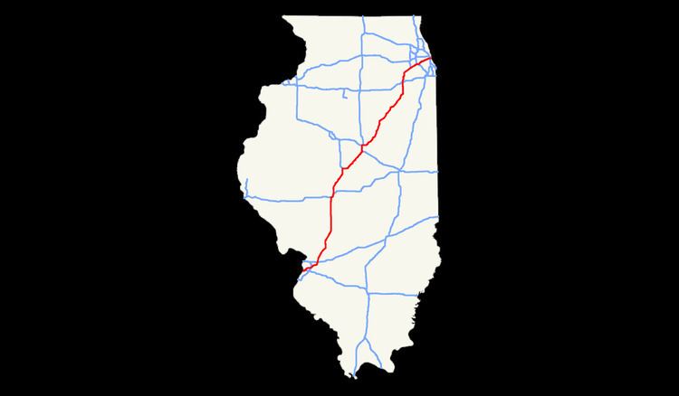
Interstate 55 (I-55) is a major north–south Interstate Highway in the U.S. state of Illinois that connects the St. Louis, Missouri, and Chicago metropolitan areas. It enters the state from Missouri on the Poplar Street Bridge near East St. Louis and runs to U.S. Route 41 (US 41, Lake Shore Drive) near downtown Chicago where the highway ends, a distance of 294.38 miles (473.76 km). The Road also runs through the cities of Springfield, Bloomington, and Joliet. The section in DuPage County is officially named Joliet Freeway or Will Rogers Freeway and in Cook County is officially named the Stevenson Expressway.
Contents
Route description
I-55 within Illinois carries heavy traffic, with an average of more than 20,000 vehicles per day for most of its length. Significant portions of I-55 contain six lanes (three lanes in each direction) and are heavily used by commuters. I-55 in Illinois begins in East St. Louis on the Poplar Street Bridge over the Mississippi River at the Missouri–Illinois state line and runs southwest to northeast through the state, ending in Chicago at US 41 (Lake Shore Drive). Along the way, it goes through four metropolitan areas in the state: the Illinois portion of the St. Louis metropolitan area, the Springfield metropolitan area, the Bloomington-Normal metropolitan area, and the Chicago metropolitan area (also known as Chicagoland).
I-55 enters the Chicago metro area as the Stevenson Expressway and provides easy access to downtown Chicago via both the I-90/I-94 (Dan Ryan Expressway) interchange and US 41 (Lake Shore Drive) at the northern terminus of I-55, near Cermak Road and the lakefront.
History
I-55 in Illinois is the fourth road to connect St. Louis and Chicago. The first was the Pontiac Trail in 1915. This was largely improved and paved as the new Illinois Route 4 (IL 4) by 1924. In 1926, IL 4 was designated as the route of the new U.S 66, and a new section of US 66 was built to bypass slower sections of IL 4 south of Springfield by 1930. Through the 1950s US 66 was continually widened, straightened, and improved to handle its growing traffic, until its entire length was four lanes wide by 1957.
The roots of I-55 could be traced back to the need of a national highway system. President Dwight D. Eisenhower saw the need of a national network of highways that would help with the mobilization of the army. He had been impressed with the autobahn he saw in Germany during World War II. In 1956 he signed the Federal Aid Highway Act into existence. Although the act provided for a highway replacing Route 66, it was spared destruction for a while because of it being more modern than other routes at the time. Illinois would build its first new Interstate highways on other routes such as I-80, I-57, and I-70, before turning its attention once again to the St. Louis-to-Chicago route.
However, during the 1970s, Route 66 was finally replaced by I-55 as the fourth St. Louis-to-Chicago highway, serving most of the same communities along the way as the original Pontiac Trail. It was built in sections across Illinois, often on the original Route 66 roadbed. A common construction tactic where Route 66 was already four lanes wide, was to build new southbound lanes for I-55 west of the original road, then rebuild the original southbound lanes of US 66 to be the new northbound lanes for I-55, leaving the original northbound lanes of old US 66 as a two-way service road. One can find many signs posted for Historic US 66, especially where it deviates from I-55.
The earliest stretch of I-55 was a portion of US 66 which had already been built as a freeway between Gardner and I-294 (Tri-State Tollway) in Indian Head Park, and which was added to the Interstate system by simply erecting new signs in 1960. Later portions of the highway were built in the 1960s between East St. Louis and Hamel, as bypasses of Springfield and Bloomington-Normal. The rest of the road was completed in the 1970s.
The Stevenson Expressway opened on October 24, 1964 as the Southwest Expressway. It was renamed after Adlai Stevenson, the former governor of Illinois, on September 1, 1965, a month and a half after his death. The Stevenson's original termini were US 66 in DuPage County to the west, and the Dan Ryan Expressway to the east.
In 1999–2000, the expressway was completely rebuilt from Central Avenue north to Lake Shore Drive, including the ramps to the Dan Ryan. The Illinois Department of Transportation (IDOT) was criticized at the time for not adding a fourth lane in each direction to the highway.
Recent upgrades and current construction
Because of the heavy traffic on I-55, IDOT must spend millions per year maintaining the roadway, adding lanes, and replacing bridges to increase the capacity of the highway.
In northeastern Illinois near Joliet, a widening project that expanded I-55 from two to three lanes in each direction between I-80 (exit 250) and Weber Road (exit 263) was completed on October 29, 2008.
In the 2000s decade, the Damen Avenue (exit 290) and Pulaski Road (exit 287) interchanges were rebuilt as a single-point urban interchange (SPUI) configuration; in 2014 reconstruction as a SPUI was completed for the Central Avenue (exit 285) interchange. The Arsenal Road (exit 245) interchange was under complete rebuilding and reconfiguration as of 2012, and the deteriorated overpass at IL 129 (exit 238) was removed in 2012 in anticipation of future construction of a full interchange, temporarily leaving the IL 129 interchange with only a northbound exit and northbound entrance.
At St. Louis, the Stan Musial Veterans Memorial Bridge carrying I-70 across the Mississippi River, and costing $667 million, was completed in 2014 to relieve congestion on I-55's Poplar Street Bridge.
Future
Governor Bruce Rauner, in early 2016, made a proposal to explore expanding the Stevenson Expressway portion of I-55 by adding an additional lane in each direction to ease congestion. Under his proposal, toll lanes would be constructed and operated through a potential private-public partnership.
Auxiliary routes
I-55 has three auxiliary routes in Illinois:
Springfield business loop
Business Loop 55 refers to a major arterial surface street that serves downtown Springfield, Illinois. It runs north from the intersection of Interstates 55 and Interstate 72 through downtown to Illinois Route 4 (Veterans' Parkway). It then runs northeast to Sherman.
All of Business Loop 55 was part of U.S. Route 66 at some point.
Major junctions
The entire route is in Sangamon County.
Lincoln business loop
The Lincoln business route services the downtown of Lincoln, Illinois. It begins southwest of Lincoln and follows the former US 66 to Fifth Street. It then turns east on Fifth Street, southeast on Clinton Street, and northeast on Kickapoo Street at the city's center. The route continues northeast to rejoin the former routing of US 66 northeast of town near the Logan County Airport, at which point it continues along that route to end at I-55 further northeast of Lincoln.
Bloomington–Normal business loop
The routing of the Bloomington-Normal business loop is known for its entire length as Veterans Parkway. It is a divided, limited-access highway bypassing the Bloomington-Normal area to the south and east. The route's north-south portion largely passes through a retail core, including Eastland Mall and The Shoppes at College Hills.
Major junctions
The entire route is in McLean County.