
 | ||
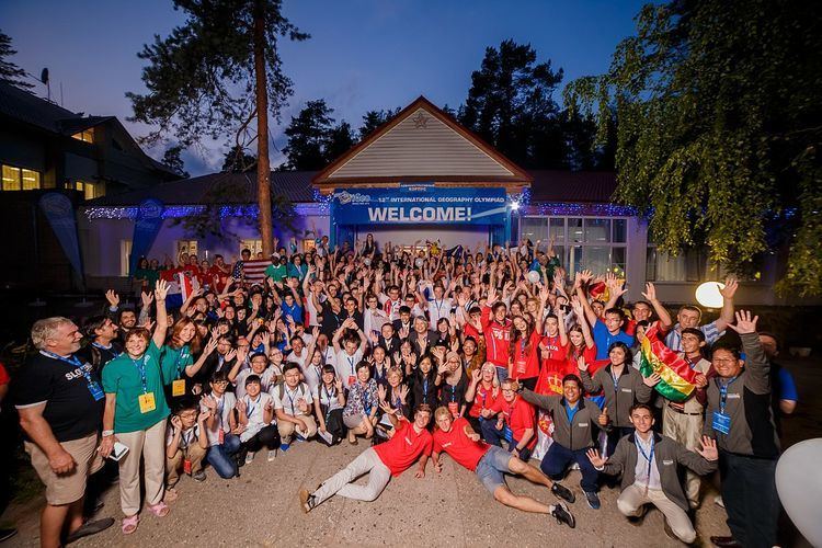
The International Geography Olympiad (iGeo) is an annual competition for 16- to 19-year-old geography students from all over the world. Students chosen to represent their countries are some of the best, chosen from thousands of students who participate enthusiastically in their own National Geography Olympiads. iGeo tests the abilities of every participants in spatial patterns and processes. The iGeo consists of three parts: a written test, a multimedia test and a substantial fieldwork exercise requiring observation, leading to cartographic representation and geographical analysis. The programme also includes poster presentations by teams, cultural exchanges, and time for students to get to know their fellow students and explore the host city.
Contents
- History of competition and national success
- Aims
- Process
- Testing
- Topics tested
- Written response test 40
- Fieldwork exercise test 40
- Multimedia test 20
- Awarding medals
- References
The International Geography Olympiad is organised by the International Geographical Union (IGU) Olympiad Task Force, who produce tests with reference to the local organisers and the international board.
After the first iGeo in 1996, it was recommended that the competition was held biennially. Due to the competition growing in popularity, since 2012 the competition has been held annually, rather than biennially, as is the case with the other large International Science Olympiads.
History of competition and national success
During the 1994 Congress of the International Geographical Union (IGU) in Prague, people from Poland and the Netherlands launched the idea of an International Geography Competition (iGeo) or Olympiad for students between 15 and 19 years of age. The first one was held in 1996 in The Hague, Netherlands, with five participating countries. The participant count grew to 24 countries with the 2008 competition in Carthage, Tunisia.
At the most recent iGeo, held in Beijing, China in August 2016, there were 45 participating countries. In addition, representatives from Canada and Kyrgyzstan were present as official observers, with an aim to participate in future Olympiads.
The next Olympiad is the 2017 iGeo, which will be held in Belgrade, Serbia in August 2017.
Aims
Aims of the International Geography Olympiad:
Process
iGeo is a competition between students. Every country or region that participates in iGeo should send a team composed of 4 students.
Contestants must be secondary school students, or has not yet begun higher education. Their ages must be under 20 before June 30 in the same year.
In addition to the students, there must be two adult representatives, one of whom is the team leader and the other is responsible for special tasks such as translation.
English is the official language of the Olympiad. All participants must present their answers in English. Participants whose first language is not English are provided with a printed multi-lingual dictionary minus geographical terms.
Testing
iGeo assessment consists of 3 parts. A written response test (40%), a fieldwork and decision making exercise (40%), and a multimedia test (20%). The champion has the highest combined total score from all tests. As iGeo participants are part of their own national teams, each nation will also have a combined score of their 4 team members. Both ranking tables from these categories are usually released on the webpages of the specific iGeo following the event's conclusion.
Topics tested
The tests are based around these 12 pre-defined topics:
- Climate & climate change
- Hazards & hazard management
- Resources & resource management
- Environmental geography & sustainable development
- Landforms, landscapes & land use
- Agricultural geography & food problems
- Population & population change
- Economic geography & globalisation
- Development geography & spatial inequality
- Urban geography, urban renewal & urban planning
- Tourism & tourism management
- Cultural geography & regional identities
Written response test (40%)
The written response test consists of 6 chosen topics from the defined 12 topics (students spend approx. 20 - 25 min. per topic in the exam), with issues that are geographically and socially relevant, that require topical and applied geographical knowledge and geographical skills and deal with physical and human geography, preferably integrated. Each topic has several resource materials such as maps, photos, graphs, statistics. Each topic consists of several questions which are based on the resource materials and range in length from short answer to paragraph length. They may involve completion of a matrix or a table, or the manipulation of data (eg from tabular to graphic form). The choice of the 6 topics from the list of 12 is made by the committee that designs the test. There is a balance between physical and human geography in the test.
Fieldwork exercise test (40%)
For the fieldwork exercise students are presented with a spatial problem situated in the area near to where the Olympiad is taking place. Students produce accurate cartography in an initial mapping exercise and then, on the basis of the mapping exercise and the analysis of all the information about the case, the participants have to design a spatial plan (in appropriately annotated cartographic form) that tackles the problem presented, and give an explanation of the choices they have made to solve the problem that was presented.
Multimedia test (20%)
The Multimedia test is a digital multiple choice test containing 40 items, which tests all 12 defined topics of iGeo. Each item is a piece of multimedia, so consists of a map and/or digital photo, film or graph and a short question with 4 options. The test includes questions that require basic geographical thinking skills, where the contestants analyse information in maps, diagrams or photographs. Perhaps unlike other sections of the Olympiad, the Multimedia test is not intended to test the ability of the contestants to reproduce geographical facts but to test their skills in geographical analysis.
Awarding medals
Participants qualify for the finals of the Olympiad by winning a place on their national team through their country's national geography olympiad, but the focus of the international competition is on individual performances, even though national team performances are calculated and ranked officially. Therefore, medals are awarded to individuals and not to teams.
There are no official honours for outstanding performances in individual tests, although competitors are made known of the breakdown of the scores so can see where they placed in each test.
Gold, Silver, and Bronze medals are awarded to successful students at iGeo, with the number of medals awarded growing proportionately to the number of participants. In 2014, 12 Gold, 24 Silver, and 36 Bronze medals were awarded, although this increased in 2015 to 13 Golds, 27 Silvers, and 40 Bronzes.
In 2016 the lowest score for the medal winners was ~54/100, and the highest 75.2/100.