
Width 7.5 km (4.66 mi) Highest point Vattafjellet Elevation 162 m Municipality Vikna | Length 14 km (8.7 mi) Highest elevation 162 m (531 ft) Area 99.2 km² | |
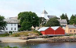 | ||
Inner-Vikna (sometimes Indre Vikna) is the largest of the three major islands in the municipality of Vikna in Nord-Trøndelag county, Norway. The 99.2-square-kilometre (38.3 sq mi) island is located in the eastern part of the municipality and it includes Rørvik, the administrative centre of Vikna.
Map of Inner-Vikna, 7900 R%C3%B8rvik, Norway
Norwegian County Road 770 runs across the island, and also passing by Rørvik Airport, Ryum, then it continues over the Nærøysund Bridge and Marøysund Bridge to connect the island to the mainland. The relatively flat and barren island is separated from the mainland by the Nærøysundet strait.
References
Inner-Vikna Wikipedia(Text) CC BY-SA